
Hog’s Head to Sneem Geosites
LOCATION: South and West Iveragh
Geologic Context
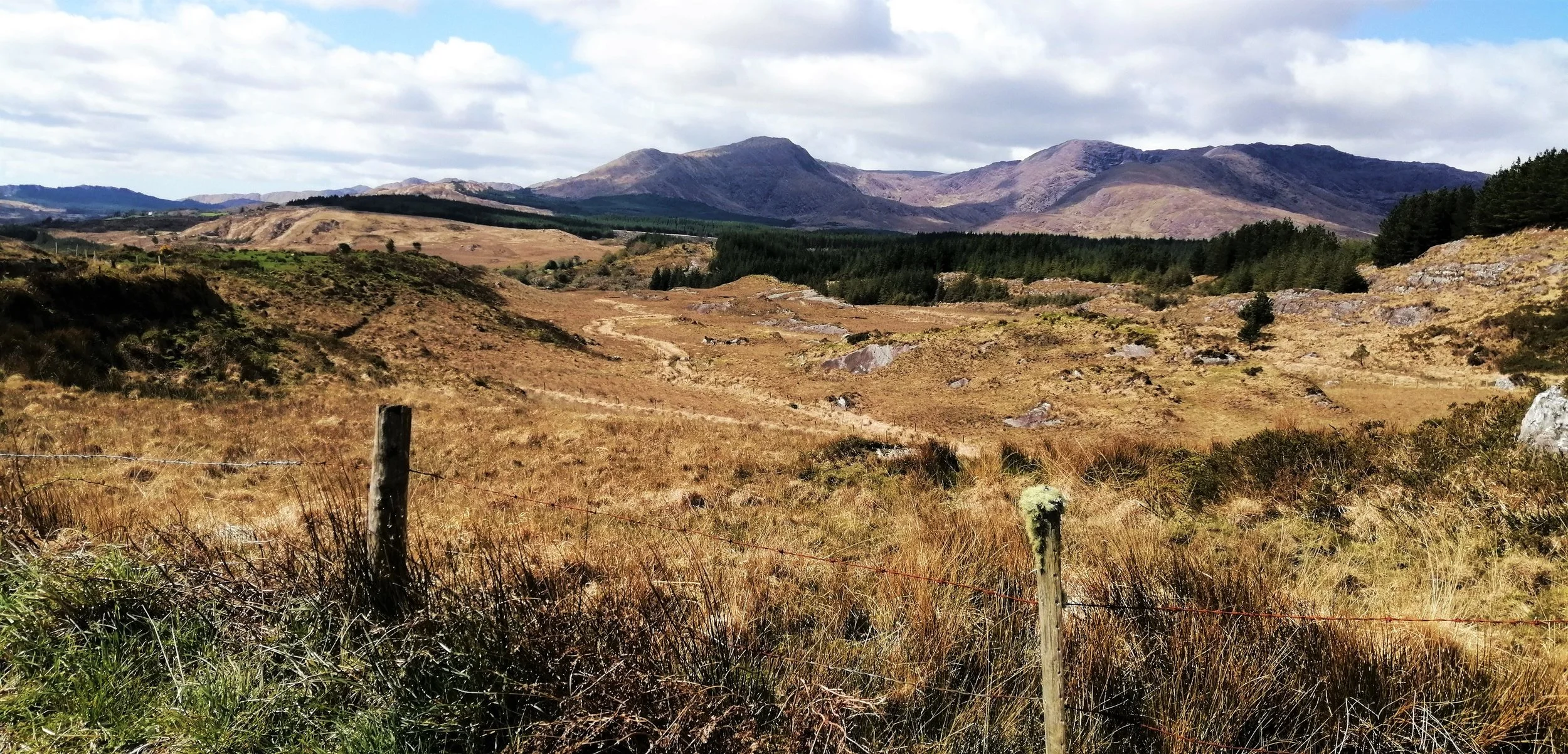
The landscape of Iveragh has been shaped by geological forces over hundreds of millions of years. Over the past 390 million years the area has migrated across the equator, been covered by hot deserts, submerged beneath shallow tropical seas, and buried below thick ice sheets. The area from Hog’s Head to Sneem is geologically rich and diverse with stunning beaches, mystical coral coves, and towering mountains. The landscape has been shaped by the action of glaciers that exploited weaknesses in the rocks to erode deep valleys and hollows, scoured bedrock to create craggy outcrops, and filled valleys with glacial deposits. These tell a compelling part of the natural history and illustrate the extraordinary range of interesting environments and geomorphologic features created by Earth processes.
The three major regional formations of the Iveragh Old Red Sandstone: the Valentia Slate Formation, St. Finian’s Sandstone Formation, and Ballinskelligs Sandstone Formation are all found between Hog’s Head and Sneem.
The geology of the area tells a remarkable story. The map below highlights some of the best places to take in the extraordinary geology and see some spectacular scenery for yourself.
HOW TO EXPERIENCE THE MAPS:
The map locations can be seen on your mobile device. Clicking on the square icon in the top right hand corner of the respective map to open the map in a web browser or Google maps app. Or you can click on the square in the top left of the map to view it on this page.
TRAIL GUIDE:
Below the maps is the guide for the map and the selected points.
There is also an alternative Storymap:
Hog’s Head to Sneem Geosites
-

01. Hog’s Head
Hog’s Head is a majestic headland that marks the southern extent of Ballinskelligs Bay. Parking
is limited but it is possible to park at Loher Stone Fort and Ardkeragh. Walking through the Kerry countryside is always a satisfying way to spend a day and from both locations, you can enjoy a spectacular walk down the winding road leading to the end of this beautiful headland of expansive views and lush vegetation.
The area is underlain by thick units of glacial till that were deposited towards the end of the last glaciation and stand as cliffs of unconsolidated clay, mud, pebbles, and boulders. Further evidence of the glaciation is provided by the numerous boulders strewn across the area. Some of the boulders have been split through the action of ice freezing and thawing within the cracks of the rock. A pier located about halfway down the headland allows you to get a closer look at these glacial deposits and to examine the pebble beach and rocky outcrops below. These rock outcrops are purple siltstones and sandstones that have been smoothed and eroded by the action of the ocean and dip steeply due to the compression of the mountain building. Looking closely at the rock surface you may notice areas containing larger deformed pebble-sized clasts. These were ripped up from the riverbed and transported by the channels that once flowed across the area and now form a rip-up clast conglomerate.
Hog’s Head also contains some of the youngest rocks on the peninsula. These are igneous rocks that are exposed as a small intrusion called a dyke. These rocks belong to a period known as the Palaeogene, which lasted from about 66 to 23 million years ago. The major event occurring at the time was the opening of the North Atlantic Ocean along the Mid Atlantic Ridge. As the continental crust was torn apart, huge volumes of molten rock from deep within the Earth upwelled to the surface and cooled quickly to form new sections of Earth’s crust. The dyke at Hog’s Head would have formed as the upwelling magma spread out and forced its way through a fracture in the earth’s crust, where it cooled and solidified below the surface. This dyke can be seen exposed at a small inlet, located just before the road crosses over to the south side of the headland.
-

02. Derrynane Lagoon
Derrynane is a special place that records a range of geologic processes, extending from the formation of the rocks to the sculpting of the landscape by ice. In addition to these more distant events, current coastal processes can be observed in action. Coastal processes are controlled by the action of the waves and create some interesting features of coastal deposition and erosion.
Derrynane is possibly best known for its incredible stretch of sandy beach and clear turquoise waters, which is often cited as amongst the finest in the country. The beach is all the more enchanting for the beautiful backdrop of the Farraniaragh and Cahernageeha Mountains and Derrynane woods.
The beach extends as a wide sand bar across Derrynane Bay and stretches back inland into a large dune system. Dunes form through wind action and are initiated when sand blown up the beach is trapped behind an obstacle such as a pebble or a lump of seaweed. Once formed, dunes are critical for supplying sediment to beaches, protecting coastal zones, and creating vital habitats for a variety of plant and animal species. At Derrynane, the most important inhabitant of the dune environment is the Natterjack toad (Cnádán). The Natterjacks hibernate in burrows dug into the sandy soil and lay toad spawn in the ponds found in the dune slacks at Derrynane. The natterjack toad is Ireland’s only toad and rarest amphibian.
Dunes are highly dynamic, and their mobile nature means that conservation can be challenging. Climate change impacts such as increased storm frequency and sea level rise are growing concerns for the survival of dune habitats. Despite concerns over dune and beach erosion, the removal of large volumes of sand occasionally reveals interesting artifacts. In Derrynane, middens, which were used as dumping sites for shellfish remains, dating from the Medieval Period have been exposed after storm events.
The sand bar at Derrynane almost fully encloses the bay to form a lagoon that is tidal and uniquely influenced by both fresh and saltwater, allowing for the creation of marshy ground and tidal flats that provide a sanctuary for many species of bird. The Derrynane Seashore Nature Trail, created by environmentalist and multimedia artist Vincent Hyland explores the habitat of the dune system and the area behind the sand bar at Derrynane and is a must do in the area.
-

03. Derrynane Mass Path
The Derrynane Mass Path crosses a range of fascinating habitats. Here we will highlight some of the major geologic features but make sure to check out our self-guided StoryMap (https://storymaps.arcgis.com/stories/caa536dfd48b4cdd9c358c9b2211d756) for more information on the history, natural heritage, and wildlife of the route.
Derrynane Beach is scattered with numerous rocky outcrops that protrude out from the golden sands. These appear as distinctly smooth bumps, not dissimilar to the hump of a whaleback breaching the water. This smooth shape was created by the action of rocks and debris embedded at the base of ice sheets, scouring and polishing the bedrock as the glaciers advanced across the area, around 25,000 years ago. The orientation of these rock bumps indicates the direction of ice flow and highlights the movement of the ice sheets westwards towards the Atlantic.
Leaving the beach, the Mass Loop continues along the spectacular coastal path. This path takes you through a landscape of secluded inlets and coves, patches of woodland, and walls of purple and green rocks. Stopping at one of the small inlets to examine the pebbles, you will notice that the rocks are striking purple, red and green colours that are characteristic of the local Old Red Sandstones and have been rounded and smoothed by years of rolling by the waves. Lumps of white quartz stand out brightly from the coloured rock mass. Many of the pebbles contain sedimentary features that provide clues as to how they formed. These include fine parallel layers of varying colour and grain size known as laminations and inclined layers at various angles known as cross-laminations. Cross laminations indicate that the sediment was being transported and moved by wind or flowing water.
Looking around at the rock outcrop that surrounds the Mass Path today, it is clear the Old Red Sandstones no longer lie in their original horizontal layers but have been overturned to dip at various steep angles. Nowhere highlights this better than the ripple marks that are exposed on a near vertical rock wall in the wooded section at Iskeroon. These ripple marks, similar to what you would see on a beach today, formed through the deposition and transport of sediment by the currents of flowing water. The ripples here would have formed along an ancient riverbed and been buried rapidly by an influx of sediment, preserving these wavy ridges, only to be exposed at the surface again some 370 million years later.
-

04. Abbey Island
Abbey Island is well worth the short detour off the Mass Path and is accessible at low tide. The 8th century monastery on Abbey Island was founded by St. Finian, a strong figure across the peninsula, often referenced in place names. In fact, the name Derrynane comes from the Irish ‘Doire Fhíonáin’ meaning the Oak wood of Fíonáin.
Abbey Island is attached to the mainland of Derrynane by a narrow strip of sand. A ridge of sand or shingle that joins a former island to the mainland in this way is known as a tombolo. Tombolos form when a sand spit grows in length until its seaward side reaches a nearby island. Tombolos tend to form because the sheltering presence of the island creates an area of slow-moving, low-energy water behind the island which favours sediment deposition.
The western coast of Abbey Island contains spectacular cliffs. These cliffs may not be as high as some of the others in the area but stand out due to the impressive rock layers and geologic folds and bends they contain. The cliffs give a great insight into how the rocks of the area formed, with layers of sediment building up over repeated influx events such as floods or the existence of a river channel. Later the layers were bent and crumbled as they were caught in the geologic vice of a plate collision. The small folds here are especially good for showing how smaller folds can form superimposed on the larger ones that dominate the geologic structure peninsula. At the base of the cliffs where the water thrashes against the rock, is a Pol Gorm, a natural nearly rectangular pool, that formed through the erosion of the rocks by the sea. The rectangular shape of this pool is likely related to a regular pattern of fractures that penetrates the rock structure and creates lines of weakness along which the rock has preferentially eroded.
If you’re a keen birder, you’ll definitely want to turn your eyes skyward, as Choughs (Cág Cosdearg) (https://www.ecomuseumlive.eu/post/red-billed-chough) often frequent these cliffs. Keeping your eyes to the ground you might spot some of Iveragh’s Common Lizards (Earc Luachra) or the rare Kerry Lily (Lile Fhíonáin).
-

05. Islands
The Iveragh coast is home to many iconic islands. Following the Ice Age sea level rose and flooded the landscape with many of the landmasses becoming islands. Scariff, Deenish, Moylaun, and Two-Headed Island dominate the waters of southern Iveragh.
Located southwest of Hogs Head, Deenish and Scariff Islands make for a majestic view. The west coast of Scariff, as the Irish name ‘Scaribh’ meaning ‘rough place’ suggests, is particularly storm shredded. Thousands of years of wave battering has cumulated in the formation of a dramatic rock face of sea stacks, caves, and cliffs and has exposed impressive geologic folds. Scariff contains the ruins of a monastic settlement and a cottage but has been long abandoned. The island has a surprisingly gruesome history and is linked with the beheading of a monk by Cromwellian Soldiers. Local tradition states that the Red Monk was captured while saying mass on Scariff Island on the 23rd of June 1653. Every year a mass is held in the Red Monks honour, with boats going out to Scariff.
The lower relief Deenish Island contains evidence of ice passing over the island during the last glacial period in the form of glacially smoothed rock surfaces. This highlights how the ice extended beyond our current day coastline, illustrating the ever-shifting nature of the landscape. This once inhabited island is now deserted and has been left to the wilderness. Deenish and Scariff Island are a designated Special Conservation Area.
Closer to the land Two-headed Island and Moylaun lie at the entrance to Derrynane Bay, just off Lamb’s Head. Two-headed island derives its name from its distinct eastern and western sections separated by a lower portion of land in the centre. Moylaun is an anglicisation of the Irish Maolán, derived from the Irish ‘maol’ meaning bare, flat-topped, and derelict.
A number of boat tour operators take you close to these islands including Skellig Coast Discovery and Skellig Tours that leave from Wavecrest and Bealtra Pier respectively.
-

06. Lamb’s Head
The long Lamb’s Head encloses Derrynane Bay to the south. A narrow road leads down to a picturesque and secluded harbour sheltered by islands and surrounded by crystal-clear water. A major fault, known as the Derreenavurrig Fault, runs along the length of Lamb’s Head, bringing the Valentia Slate Formation in contact with the St. Finian’s Sandstone Formation.
A set of steps by the pier leading to a rough path that will take you out to the end of the peninsula. Similarly to Hog’s Head, an igneous intrusion dating to the Palaeogene Period cuts through the layers of siltstones and sandstones here. The intrusion is found just opposite the island that lies to the north of Lamb’s Head and would have formed as a result of magma that was produced during the opening up of the North Atlantic Ocean.
The most fascinating aspect of Lamb’s Head is undoubtedly the significance it likely held in the Bronze Age, as the site of some of the most extensive copper deposits on the peninsula. Copper has been mined in southwest Ireland since the Bronze Age. It is amazing to think that for centuries communities have relied on geological skills and knowledge of the ground beneath our feet to support development and advancement. *Link to Aoibheann’s outputs and work on the area*
The copper found around Kerry is largely structurally controlled and closely associated with geologic faulting. When the Old Red Sandstones were being formed the continental crust was undergoing a period of stretching or extension, which resulted in the formation of a low-lying basin and the development of many geologic fractures (Lang, et al., 2020). These fractures provided pathways for copper rich hydrothermal fluids from deep within the earth to travel through the rocks. As these fluids cooled and crystallised, they formed copper rich quartz veins.
Some of the copper in the area is also found within the sedimentary rocks themselves and is therefore known as sediment-hosted copper. Sediment-hosted copper forms when copper-bearing fluid mix through permeable sedimentary rocks and copper is deposited.
To examine some spectacular geologic folds, it’s worth walking out to the sea cliffs at the western end of Lamb’s Head. These folds provide evidence of the Variscan deformation and a perfect example of a syncline or a u-shaped fold can be seen. Asides from their geologic significance these rocks can be enjoyed for the simple beauty of their folded forms.
-

07. Coad Bog
Coad Bog, located between Caherdaniel and Castle Cove is an Irish Peatland Conservation Council (IPCC) reserve (http://www.ipcc.ie/discover-and-learn/ipccs-peatland-nature-reserves/coad-bog-visitor-map-and-guide/). This blanket bog was donated to the IPCC in 2015 and is an important conservation site. Coad Bog hosts 13 different habitat types, covering an area of 4 hectares and over 200 species of wildlife have been recorded here, including Sundews (Cailís Mhuire), Orchids (Magairlín), Bog Cotton (Ceannbhán), Frogs (Frog), and Butterflies (Féilecán). Only a small amount of blanket bog exists globally, and Ireland is believed to possess around 8% of this rare habitat. Located along the Ring of Kerry, Coad Bog is an ideal spot for those eager to explore Ireland’s unique blanket bogs.
-
08. Staigue
Staigue Stone Fort is among the best examples of a stone fort in Ireland. This fort with a diameter of 27 metres and walls up to 4 metres thick made entirely without mortar, makes for a formidable sight. The fort is believed to be over 2000 years old, but precise dating is difficult.
Staigue Stone Fort has been constructed on top of a small hill and is enclosed at the head of a valley that opens up sweepingly to the south and reveals spectacular views across the Kenmare River over to the Beara Peninsula. It’s a naturally striking place.
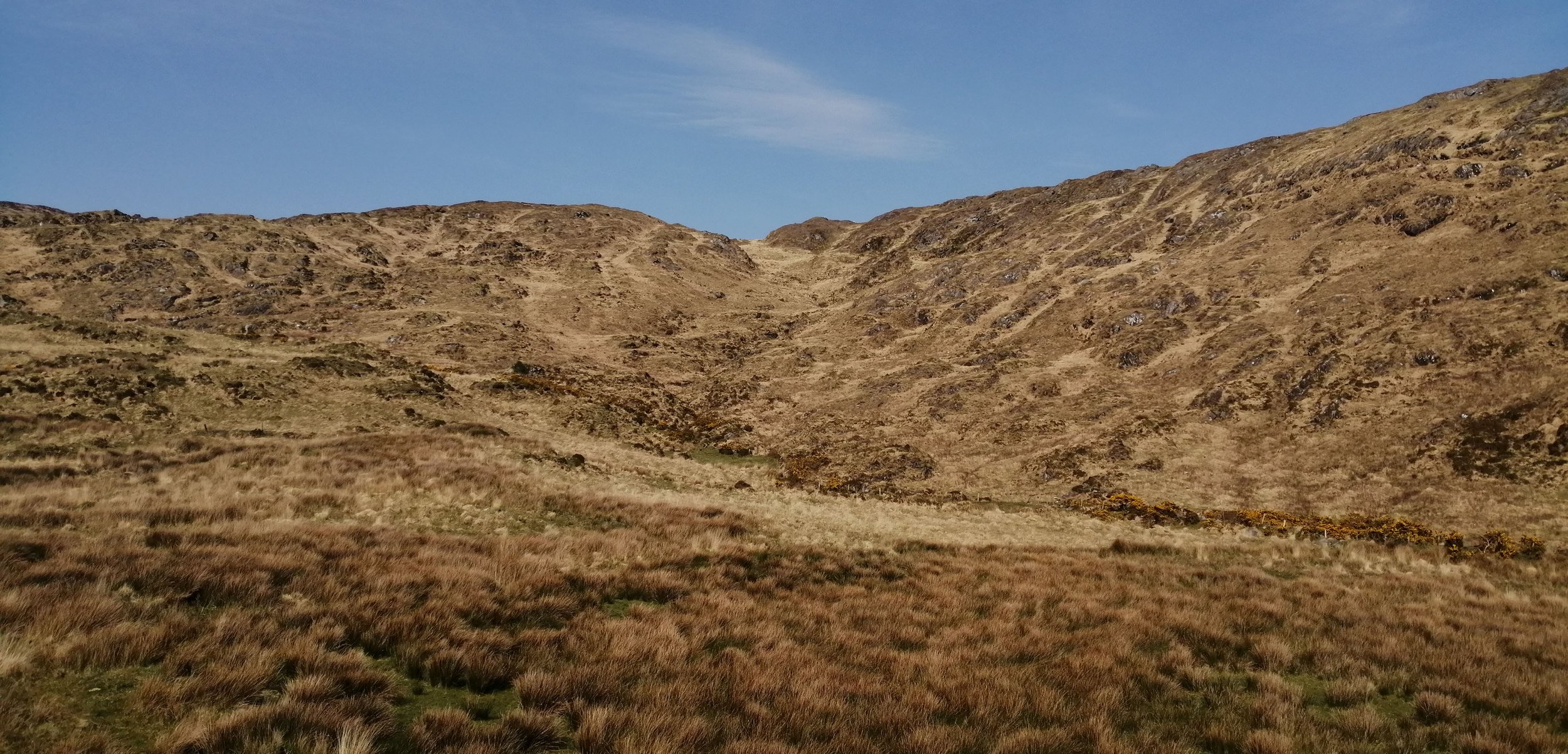
This valley would have been sculpted and shaped by glacial ice that breached the lip of the hill to the north of the fort. As the glaciers retreated a succession of undulating glacial deposits, known as hummocky moraine, were left behind. These can be seen clearly in the fields on the side of the road that leads up to the fort.
To the southeast the rocks contain copper deposits and there is evidence that copper was excavated here.
-

09. Gleesk
Somewhat off the beaten track, Gleesk Pier is a wonderful site to explore. Lying in the shadow of the overturned beds of Derreenavurruig Hill and An Bhean Mór, the pier is surrounded by numerous hummocks of rock. These rock lumps were overridden by ice sheets during the glaciation creating distinct streamlined mounds. Across the rocky shore, the purple and green bedrock has been heavily deformed and folded with surfaces that are etched by numerous quartz veins, cracks, and weathering patterns. In many places, you can witness the transition from purple to green rocks and examine the fine layers of the individual deposition events that formed these rocks. The area also contains excellent examples of geologic faults, where two blocks of rocks have been offset against eachother.
While the rocks are interesting and beautiful, the most alluring aspect of the area is the coral beach that lies a short walk to the east of the pier. The coral beach at Gleesk is not composed of coral but is made up of fragments of coralline algae or maërl. Maërl is a type of unattached coralline algae that is found in shallow waters. Unlike corals, maërl is a plant rather than an animal. These coralline algae can range in size from 1-100cm and come in a bewildering array of forms, each one unique, making for some fascinating hours of beachcombing. While typically red in colour while alive, the dead maërl washed up at this beach has been fragmented and sun bleached. These deposits have been cast up onto the beach by the waves and tides and are fed by live beds off the coast of Gleesk.
Maërl beds serve several important functions in the habitats they occupy and are protected under the EU Habitats Directive as Special Areas of Conservation. Both living and non-living beds provide a habitat for invertebrates and other marine organisms such as bivalves, crabs, and brittle stars. Maërl is primarily composed of calcium and magnesium carbonate and has been used as a fertilizer to raise the pH value of lime-poor soils in Ireland since the 1700s. While it has largely been replaced by ground limestone for this purpose it is still dredged off Bere Island on the Beara Peninsula. This type of beach is rare in Ireland and other major beach deposits are found at Carraroe, Galway, and a few other sites around Connemara (De Grave et al., 2000; Hall-Spencer et al., 2007).
-

10. Sneem
The grand scale and undeniable beauty of the landscape and geologic features around Sneem leave a lasting impression. Two major trails take you across this remarkable landscape, the Fermoyle Loop and the Lomanagh Loop. Álaind Walking provides a range of guided walking packages and experiences in Sneem and beyond for all levels of experience.
The Dunkkeron Mountain range rises to the north of Sneem village, stretching as far as Waterville in the west and all the way up to the Macguillycuddy’s Reeks to the east. Across the mountains, the original bedding layers of the Old Red Sandstones remain visible, although these have been overturned to unbelievable angles, a testament to the immensity of geologic forces.
Although the Dunkerrons are extremely old, they show clear evidence of much more recent sculpting by glaciers. During the glaciations, snow built up in existing hollows on the mountainsides of the Dunkerrons, and through continued accumulation, glaciers formed. As these glaciers grew and moved down the mountainsides, they excavated wide and deep amphitheatre shaped hollows in the sides of the mountains known as corries. Corries are extremely abundant and particularly stunning in the Dunkerron Mountains. Look out for the pyramidal peak of Mullaghanattin to the east, which was formed by the excavation of corries on all sides of the mountain. Many of the corries around Sneem contain lakes known as tarns. These lakes formed as the glaciers retreated and meltwater collected in the eroded hollows. These glacial lakes are best seen hiking through the Dunkerrons but keep an eye out for the Coomanaspig Waterfall on Knocknagantee which flows from the overlying Coomanaspig tarn, down the steeply dipping back wall of Eagle Lough Corrie.
The impact of glaciation on the landscape of Sneem is not restricted to the mountains but can also be seen across the lowlands. Fields are dotted with smoothed bumps and mounds of rocks. These slabs of rocks, have asymmetrical profiles typical of roche mountoneé, with a gentle scraped and smoothed up ice flank and a much steeper and blunt quarried down ice face, indicating the direction that the ice travelled over the area.
As the ice retreated and melted at the end of the Ice Age large amounts of debris were dumped and left behind. In Sneem, these deposits mostly take the form of moraines. Moraines are poorly sorted and unconsolidated mixtures of mud, sand, clay, pebbles, and boulders, which were carried and deposited by glacial ice. The landscape of Sneem has a distinctly hummocky appearance with vast swathes of undulating hills. These irregular mounds are known as hummocky moraines and are believed to form during periods of glacial stagnation when the ice gradually melted and lowered sediment to the surface or by the thrusting of already deposited sediment by minor ice advances.