
Islands of Iveragh
The many islands scattered around mainland Iveragh are some of the most impressive and iconic features of the peninsula’s coastline. These islands vary considerably in size, ranging from the 10.5 km length of Valentia Island to the countless islets with lengths of less than 100m. In the image header for this page, you can see Two-headed Island, Moylaun, Deenish, Scariff, and the Skelligs. Many of these are privately owned or inaccessible but can be enjoyed from the mainland or from the sea in a boat.
The islands of Iveragh are mostly the peaks of hills and mountains that formed around 290 million years ago at the same time as the peninsula’s spectacular mountain ranges, including the Dunkerron Range and the Macguillycuddy’s Reeks. When they were formed, these peaks were part of the mainland, separated from other peaks by valleys and low-lying land.
Jumping forward to the last glacial period, around 25,000 years ago, much of Iveragh was buried beneath thick sheets of ice. As so much water was locked up in ice sheets across the northern hemisphere, the global sea level was about 120m below present. However, by about 14,000 years ago these ice sheets had largely melted in lowland regions and a huge influx of meltwater drained into our oceans, causing rapid sea-level rise. This caused the islands of Iveragh to be isolated, as rising seas flooded low-lying areas, leaving only the highest peaks rising above the water. Since their isolation, these islands have been exposed to the full force of the Atlantic Ocean on all sides, which has formed their jagged and weather-worn appearance.
There are too many islands visible from the coastline to mention them all here, so we have highlighted some of the most iconic and visible. You can explore these by using the map or the guide below.
HOW TO EXPERIENCE THE MAP:
To view the map locations on your mobile device, click on the square icon in the top right hand corner of the map. Or you can click on the square in the top left of the map to view it on this page.
The Islands of Iveragh
-

01. Beginish
Beginish or ‘Beiginis’ in Irish, which translates as ‘Little Island’, lies off the north shore of Valentia Island, nestled between Valentia and Doulus Head. Although small, it’s home to some fascinating geological features and has huge cultural significance.
Archaeological evidence of Viking settlement between the 9th and 12th centuries consists of a circular stone dwelling, outhouse, and midden. The nearby Church Island is home to a 7th century monastery with an oratory and hut, a holy well, and shrine.
Beginish is the centre of one of the few areas of igneous rocks on the peninsula and the intrusion of the rock called dolerite shows columnar jointing, like that found at the Giant’s Causeway. Of particular interest to the glaciology of the area is a raised beach deposit running along the island's north coast. This raised beach provides direct evidence of a time when the sea level was higher than today. At Beginish the raised beach is interbedded with two glacial deposits which suggest that the beach likely formed during a brief warm period between two glaciations (Mitchell, 1992).
There are boat tours of Beginish and Valentia harbour on offer that combine geology, culture, folklore, history, and ecology. You can also admire this island from the land at several locations, particularly from the upland areas of Valentia, Cahersiveen and ‘over the water’, and from the beach at Glanleam. -
02. Puffin Island
Lying off the coast of Lettercamps near Keel, at the entrance to the Portmagee channel, this steep rocky island is the detached tip of a promontory that is now separated from the mainland by the narrow Puffin Sound. The island has a distinctive two-humped form. From some aspects, it looks as if it has been severed in two. This dramatic effect is created by a geological fault that runs from the north to the south of the island. Puffin Island hosts high cliffs, storm beaches, and dramatic rockfalls.
The island is an important Birdwatch Ireland reserve and you can watch throngs of birds swirling overhead during the summer months. The steep cliffs provide ideal nesting spots for the thousands of Puffins (Puifín), Storm Petrels (Guairdeall), and Manx Shearwaters (Cánóg dhubh), that nest on the otherwise uninhabited island.
Puffin Island is clearly visible from Bolus Head, the Kerry Cliffs, and Bray Head. -

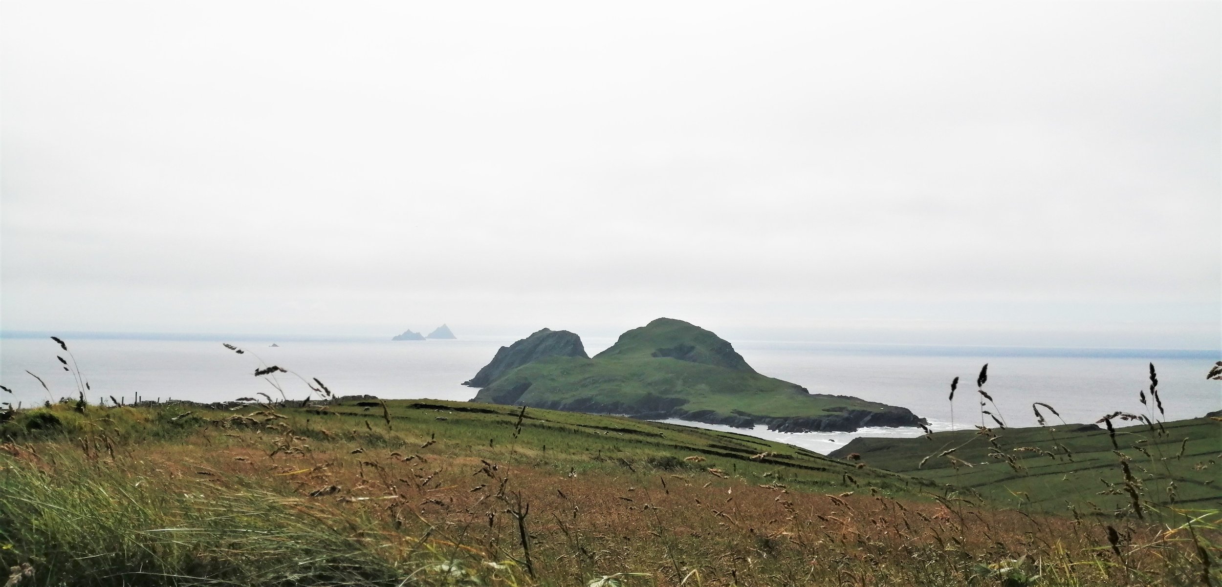
03. Skellig Islands
The world-famous Skellig Islands are among Iveragh’s most iconic landmarks. These precipitous crags lie 12km off Bolus Head, making them the westernmost point of the Peninsula. Skellig Michael and the nearby Little Skellig are composed of the same Old Red Sandstone Formation which covers much of the Iveragh Peninsula. The towering pyramid of Skellig Michael also contains a smaller deposit of volcanic ash, known as tuff.
Skellig Michael is famed for its 6th century monastery and hermitage and is a UNESCO World Heritage Site. The most striking aspect of the structure of Skellig Michael is the twin peaks, separated by the low-lying U-shaped valley known as Christ’s Saddle. The presence of this valley is again controlled by a geological fault that runs north-south across the island (Bourke et al., 2011). This fault weakened the nearby rocks, making them more susceptible to erosion.
Little Skellig is equally impressive and is home to an important bird population. Its jagged rock pinnacles host a massive colony of some 30,000 pairs of Gannets (Gainéad), as well as many Puffins (Puifín) and other seabirds.View these dramatic pinnacles on the horizon at numerous locations across the peninsula, particularly along the western coast between Coomakista and Valentia.
-
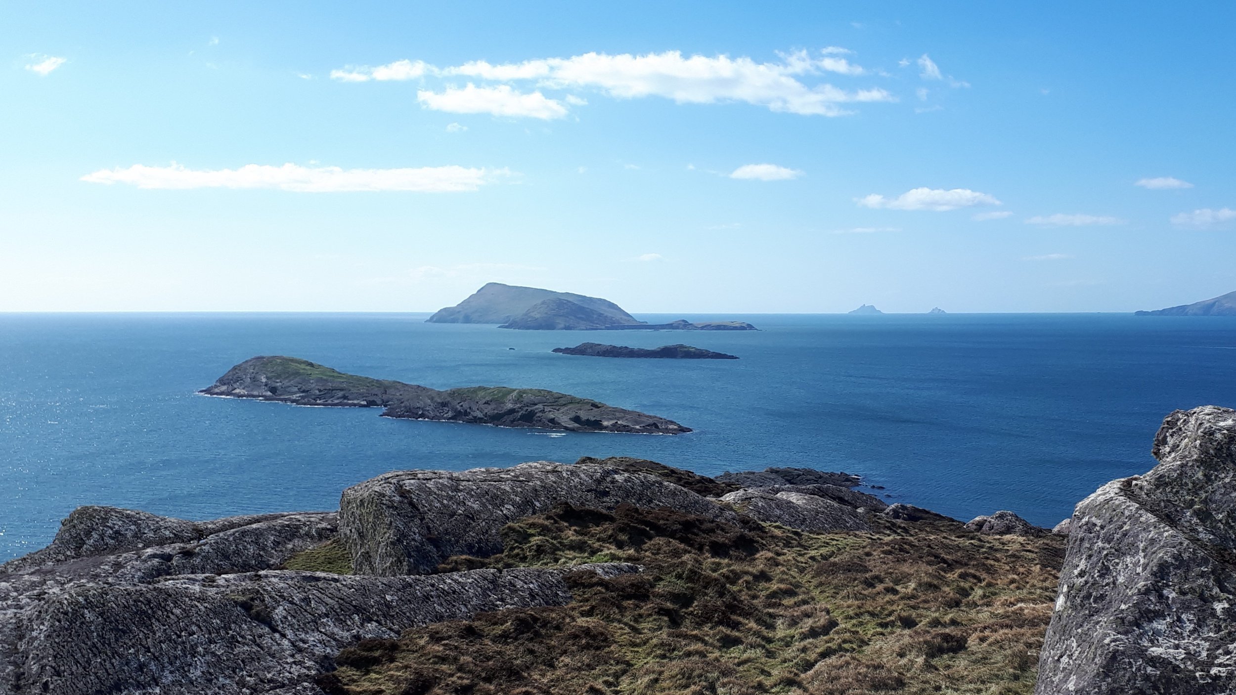
04. Scariff and Deenish
The west coast of Scariff, as the Irish name ‘Scaribh’ meaning ‘rough place’ suggests, is particularly storm shredded. Thousands of years of wave battering have cumulated in the formation of a dramatic coast of sea stacks, caves, and cliffs and has exposed impressive geologic folds.
Scariff contains the ruins of a monastic settlement and a cottage but has been long abandoned. The island has a surprisingly gruesome history and is linked with the beheading of a monk by Cromwellian Soldiers. Local tradition states that the Red Monk was captured while saying mass on Scariff Island on the 23rd of June 1653. Every year a mass is held on the island in the Red Monk’s honour.The lower relief Deenish Island contains evidence of ice passing over the island during the last glacial period in the form of glacially smoothed and polished rock surfaces. This once-inhabited island is now deserted.
Deenish and Scariff Island are a designated Special Conservation Area and are best viewed from Lamb’s Head, Hog’s Head, and Coomakista. -

05. The Bull, the cow and the calf
Located to the west of the lengthy Dursey Island on the Beara Peninsula, glimpses of this cluster of islands can be seen on clear days along the southwest coast of Iveragh. At night, you may also see flashes of light from the lighthouse on the Bull passing down Kenmare Bay. These dramatic islands are composed of the same Old Red Sandstones found on the Iveragh Peninsula, which gives them their green and purplish appearance.
Bull Rock towers 89m above sea level, and is perforated by an astonishing arched cavern. This massive tunnel passage is locally referred to as the ‘Gateway to the Underworld’. Steep jagged cliffs line all sides of this imposing island, with the incredible feat of the old Gas Works and Lighthouse clutching to the eastern cliff face.
The Cow Rock lies between the Bull and Dursey Head, is set apart by its impactful sea arch which gives the rock a distinct likeness to an elephant with its trunk resting in the water.
The Calf Island was the location of the original lighthouse, built in 1866 and composed of cast iron. On the 27th of November 1881, the lighthouse was destroyed as the tower snapped during an extreme storm, leaving behind only a stump of the former lighthouse. The lighthouse keepers survived but were stranded on the island for two weeks while they awaited rescue. The Bull Rock Lighthouse was built in 1889 to replace this structure.

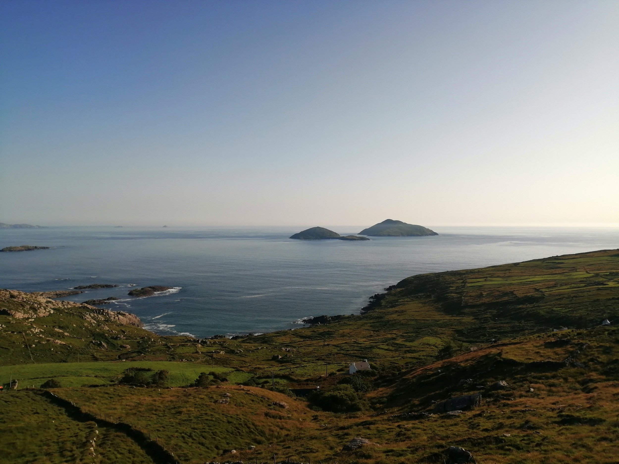
The sun setting with the silhouettes of Scariff Island, Abbey Island and the Skelligs visible.