
Cuan an Chaisleán
Castlecove

A group exploring the Kerry Way above Castlecove
Castlecove is named after the castle at the mouth of the cove where the Gowlane river enters the sea. On old maps, this is the location of Castlecove whereas the location of the current village is named ‘Bridgeville’.
With Westcove Harbour to one side and a series of sheltered sandy and rocky coves along the coast, Castlecove is an ideal destination for boaters and beachcombers.

This ancient copper mine known as St Crohan’s Hermitage is one of the many local heritage sites.
It is also a village that is surrounded by historical sites, including the ruins of the hospital established by the republican Gobnait ní Bruidair, the imposing Staigue Fort, ancient rock art, the layers of ancient history at Coad, and a shoreline where evidence of thousands of years of landscape change is evident.
Added to that, Castlecove is also close to the Kerry Way sections to Caherdaniel, Sneem, and over the Windy Gap to Waterville, so it’s a good rest point or ideal for exploring sections of the route.
For wildlife enthusiasts, look out for seals and otters at Westcove, and follow the walking trails into the hills to listen for birds.
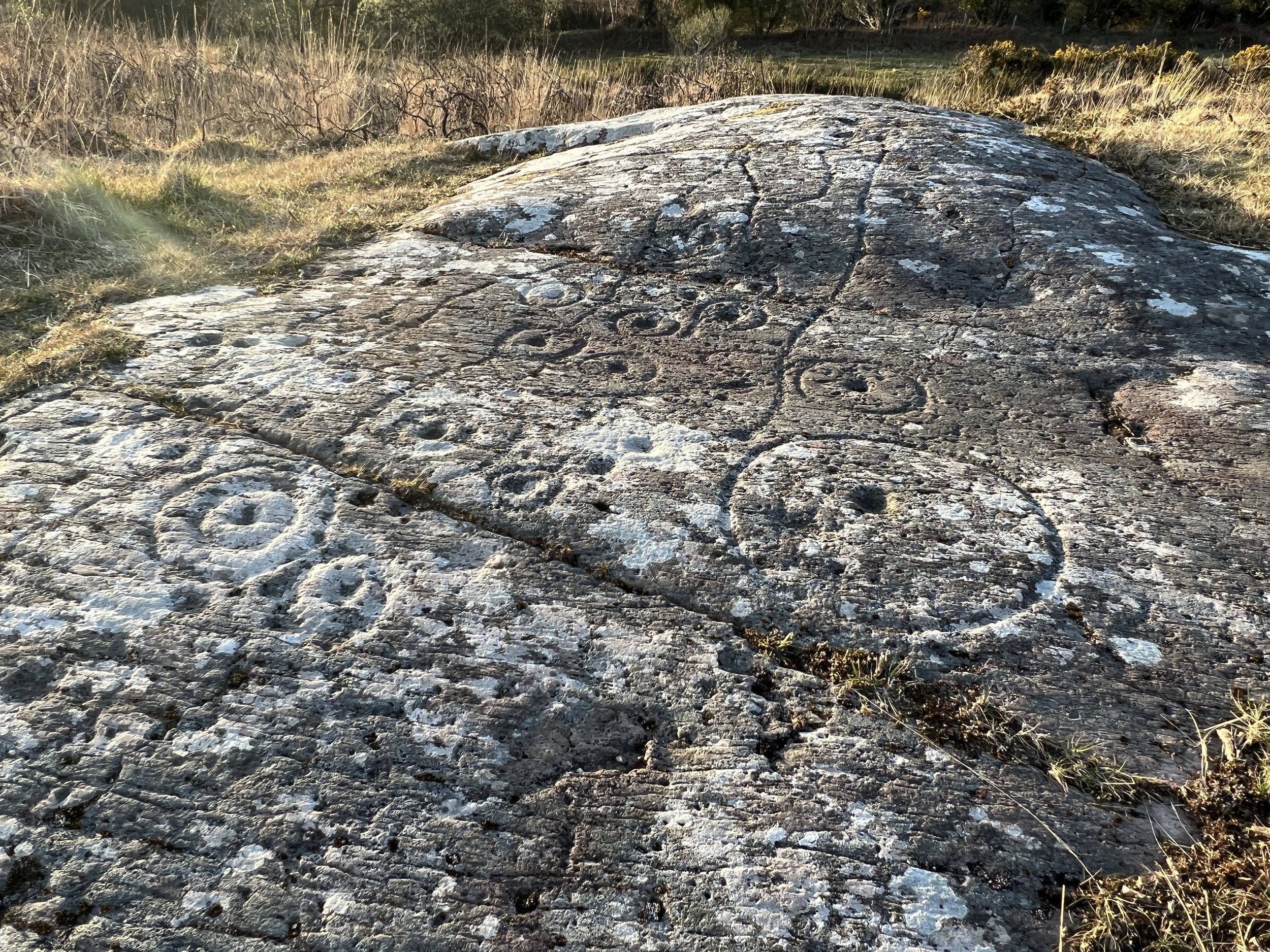
Just one of the beautiful and mysterious rock art panels visible near Castlecove.
Waterville and Caherdaniel video
Watch this short video for inspiration and take a look at our itinerary for just some of the many things to do in and around Castlecove all year. It’s a natural stopping off point on the Ring of Kerry, with various services available in the village and the nearby surroundings.
Some suggested activities


The beaches near Castlecove are beautiful at any time of year.

The imposing structure of Staigue Fort, which was built many thousands of years ago near modern-day Castlecove.