

The Trail of the Whale

Can you spot the dolphin in the image? Then you are in the right place!
Getting your head out of the clouds, this map will show you locations from where you might be lucky enough to spot some real whales, dolphins and porpoises (cetaceans). All the locations are packed with interesting facts on history, popular landmarks, nature facts and of course, what cetaceans to expect to find. For more information on cetacean species around Iveragh, visit our marine wildlife page.
About the trail
Most of the locations are located along the Ring of Kerry Road and the Skellig Ring Road with easy access and parking facilities. Some will require a walk or hike of up to 2 hours, ranging from easy to medium level of difficulty. Some locations are only reachable by boat but are mentioned because of their cultural and natural importance to the peninsula.
What to bring
If you want to increase your chances of finding cetaceans, bring a pair of binoculars. Spending most of their lives underwater, it is that moment they have to surface to breathe, when we hopefully get to see them. Keep in mind, the higher up you are standing, the further you can see, but also the further away cetaceans will be. This map therefore offers you a mix of lower and higher altitude viewing points.
To help you to identify what you see in the field, it might be a good idea to bring a guidebook with you. The Irish Whale and Dolphin Group has a guide, explaining features, distribution and behaviours of cetacean species seen in Irish waters. Additionally, it also goes into detail on how to survey cetaceans, some historical facts, a section on strandings and much more.
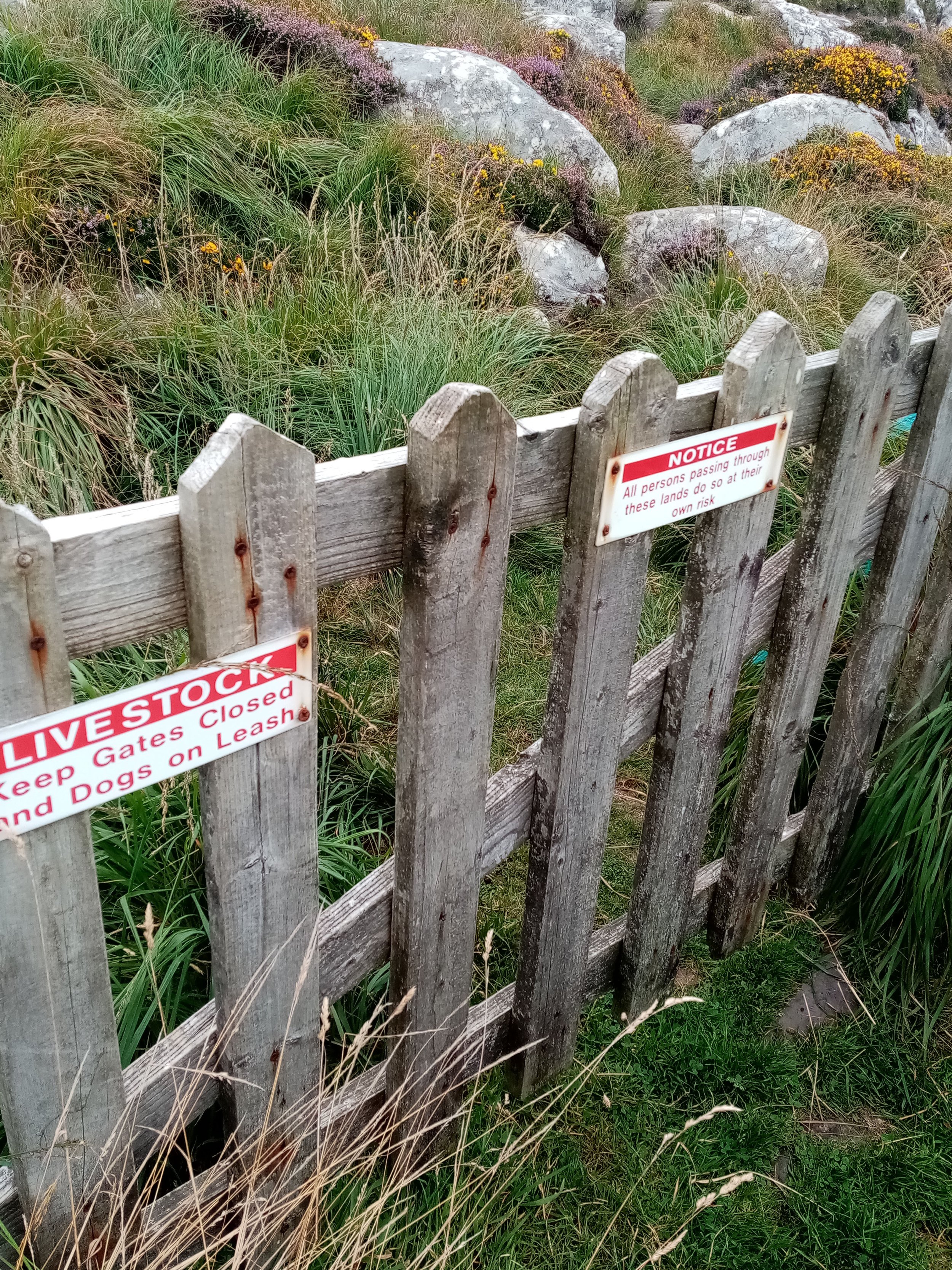
For all locations that require a walk or hike, we recommend wearing comfortable hiking boots to allow a sturdy grip on uneven and slippery surfaces, and waterproofs, as the weather can change quickly around here. As many of the trails pass over farmland, we ask all visitors to always be considerate of your surroundings and wildlife and do not bring dogs on walks through sheep grazed fields.
HOW TO EXPERIENCE THE MAPS:
To view the map locations on your mobile device, click on the square icon in the top right hand corner of the map and open it in a web browser or app. To view the map in this page, click on the square in the top left of the map to follow it on this page.
TRAIL GUIDE:
Below the maps is the guide for the map and the selected points. There is also an alternative Storymap
What are you looking for?
Finding cetaceans is often not easy and simply takes practice. The more often you observe them, get used to their behaviours and identifying features, the better you will become at spotting them. One thing to remember is that the weather plays a big part. The calmer the sea, the better. Ideally you would not want any foam or breaking waves, as little wind as possible and high visibility.
With the weather on your side, there are four main cues you want to look out for:
-

Blow or spout
The only reason we can see cetaceans at the water surface is because they need to breathe. When exhaling, the released air and small water droplets from the indentation of the closed blowholes create a cloud, called a ‘blow’, which can be observed on most animals. Depending on the species, the blow may be large, small, uniquely shaped, or barely visible at all.
-

Dark back and dorsal fin
All species we most frequently see around Iveragh, have dorsal fins. If this is halfway down the back, it is a dolphin or porpoise. If it’s 2/3rds down the back, it is a whale. Depending on the shape and location, you are off to a good start to identify the animal(s) you have seen. To find out more about distinguishing features, you can read our marine wildlife page.
-
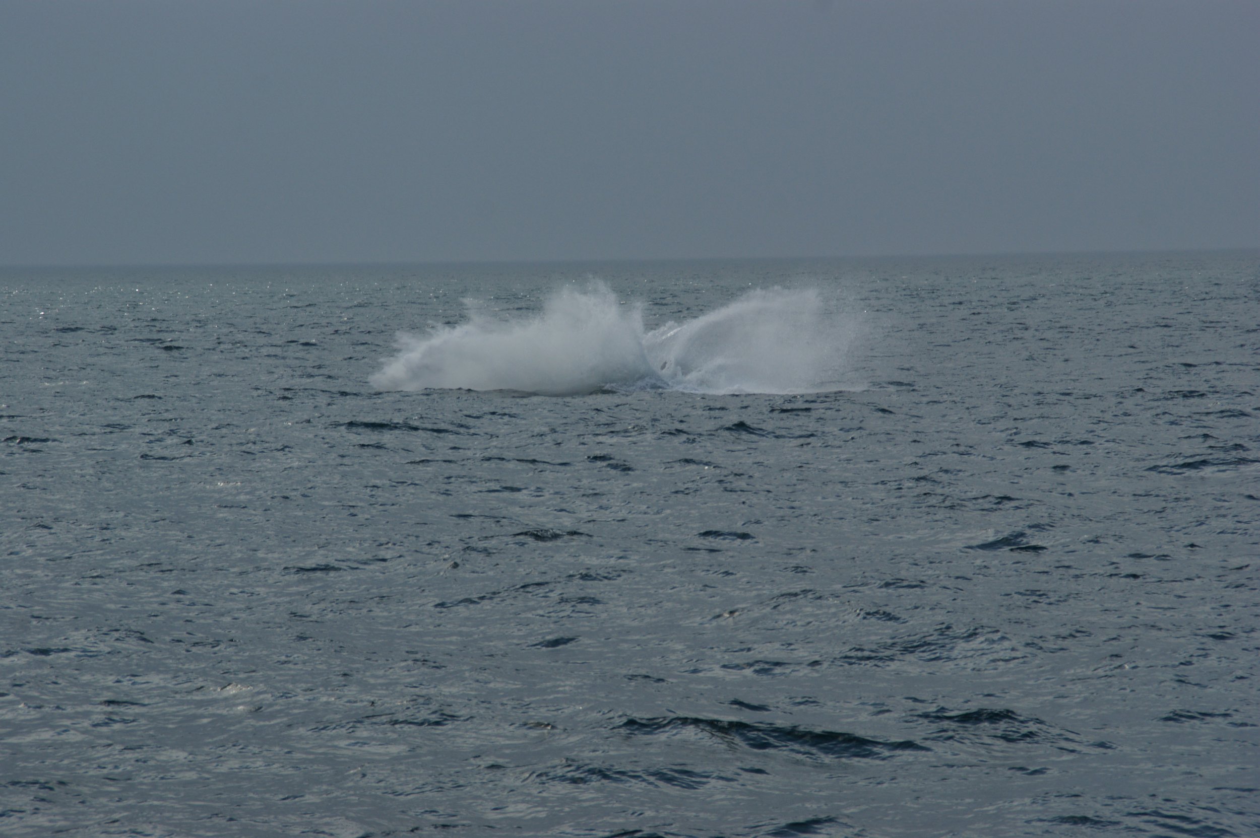
Splashes
And here comes the reason why you want a calm sea when going on your search for cetaceans: it allows you to notice splashes. Some species create them by surfacing quickly or porpoising (breaching during fast travel), whereas others will lift their whole bodies almost vertically out of the water to breach. Depending on the behaviour, these splashes can be fairly big and visible from far away. One other large marine animal to be known to catapult itself out of the water is the Basking Shark (Liamhán gréine).
-

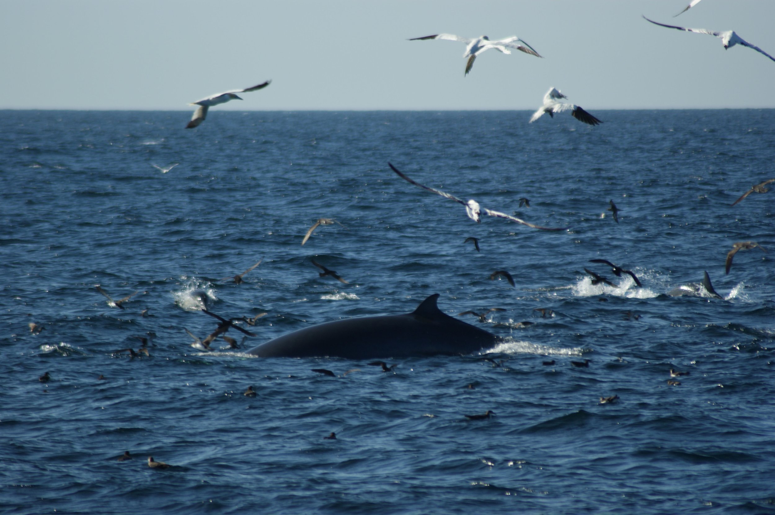
Seabirds
You might spot flocks of seabirds diving into the water and feeding. This is an indicator that there is food in the water. Where there is food, there also might be cetaceans. Look for splashes on the water surface and emerging dorsal fins, or even lunge feeding baleen whales under the birds.
-

1. Kells Sheep Centre
Following the 30km long South Kerry Greenway from Glenbeigh to Cahersiveen, you will find plenty of spots for a short rest. If you are travelling by car, the large car park just across the road from Caitlins Pub and Accommodation will give you a glimpse into Dingle Bay just as well. Frequently seen cetacean species include Common Dolphin (Deilf choiteann) and Bottlenose Dolphin (Deilf bholgshrónach), which can often occur in large pods.
Done watching for whales, you might want to watch Brendan's demonstration of his sheep dogs. Continuing then along the N70 Ring of Kerry Road, a detour through Kells will allow you a visit of the Kells Bay House and Gardens, which has one of Europe’s finest collections of exotic plants.
-

2. Foileye WWII Lookout Post No. 83
The first of 3 lookout posts built during WW II on the peninsula offers views into Dingle Bay as well as to the Blasket Islands. These lookouts were used to spot submarine vessels and to signal along the Irish coast.
Bear in mind that there is no dedicated parking space at this location. Following the tarmac road from the car park at Kells Bay Beach it is, however, a less than 3km walk.
Cetacean species frequently seen in the bay are Common Dolphin (Deilf choiteann) and Bottlenose Dolphin (Deilf bholgshrónach), which can often occur in large pods.
-

3. Doulus Head & White Strand
The trail to Doulus Head really starts at the end of road, but the only proper parking space is down by White strand. This trail is not marked but can be made out crossing the intensely grazed first part of the sheep fields. When you reach the wall to your left, just follow it along and it will bring you to the tip of Doulus. This trail is not difficult, but contains terrain that is uneven, wet, slippery and overgrown with fern and gorse. Be very careful and use your own judgement about whether it’s safe. All in all, the 4km from the car park will take about 45 minutes. But the climb will be rewarded with a fantastic, almost 360 degree view overlooking Dingle Bay and peninsula, Valentia Island and Iveragh from approximately 80m height. Doulus Head also was one of the proposed sites for a WWII lookout post in 1939, which didn’t get approval.
When returning to the rocky beach, keep your eyes open for stranded cetaceans as well, especially after stormy weather and report them to the IWDG.
-
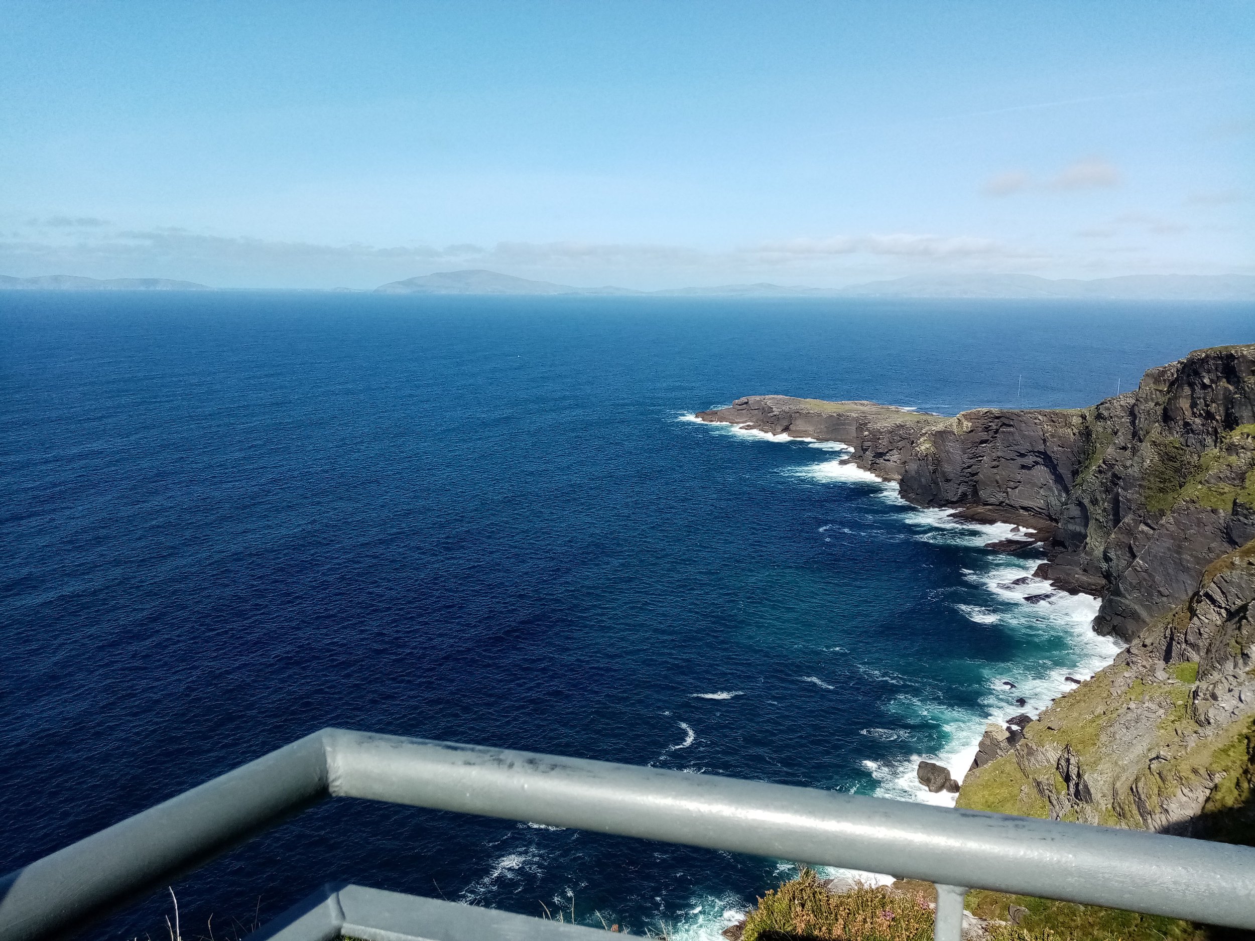
4. Geokaun Mountain & Fogher Cliffs
Pronounced “yeo-KAWN”, the origin of the Irish name is uncertain. For a small fee you can either park at the foot of the mountain and walk up or drive and enjoy the various stops to the top. If you want to stretch your legs, a loop walk circling the summit and short walking trails are available also. All viewing points and trails are garnished with over 50 information boards with lots to read about local history, mythology and wildlife. You can find up-to-date information and opening hours on the Geokaun website.
The mountain and cliffs with up to 240m height are a fantastic place not just to spot cetaceans, such as dolphins. But if you are lucky, you will also get to watch the air-acrobatics of Red-billed Choughs (Cág cosdearg) and Common Ravens (Fiach dubh).
-

5. Bray Head & WWII Lookout Post No. 35
Arriving at the car park at the bottom of the 2km long gravel path, don’t forget to pay and display. It’s only 2€ and totally worth it! The Bray Head tower is one of many that were built as a result of an abortive French invasion in 1796. Built somewhere around 1805 and 1815, it is much older than the smaller lookouts and has undergone several reconstructions over the centuries. From this 160m high vantage point you can see all the way to the Skelligs left on the horizon and to the Blaskets right on the horizon. Towards the Blasket islands a lot of Fin Whale (Droimeiteach) and Humpback Whale (Míol mór dronnach) sightings have been made over the summer months.
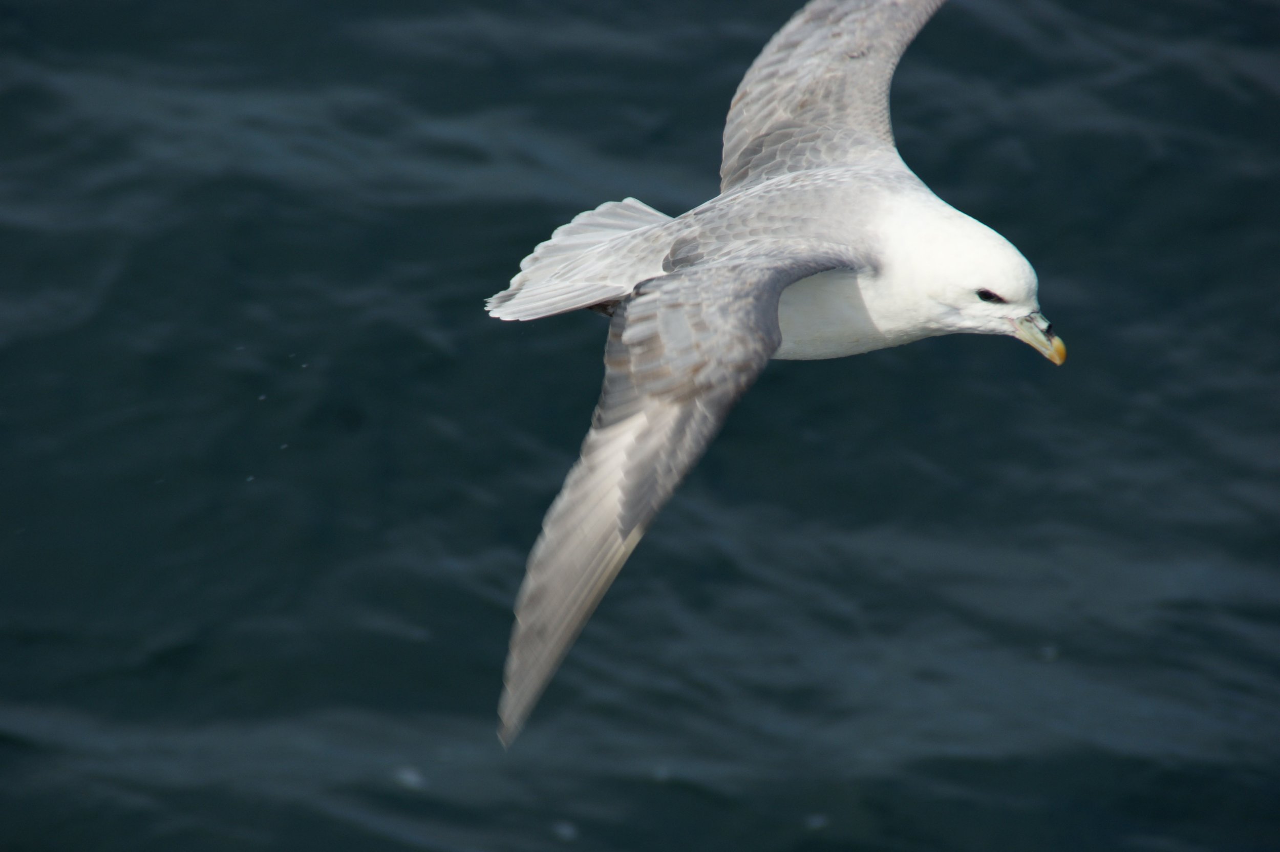
Other summer visitors you can see closer up are kittiwakes and fulmars, two bird species breeding at the cliffs. But be mindful, as there are no barriers to prevent you from falling.
-

6. Kerry Cliffs
Giving you your entrance fee worth, you can leave the car at the car park and walk up the gravel path. Along the barriers you can find various spots to look out at sea, but also to witness the fantastic bird life in the area. Standing 60 to 90m above sea level, you might see large whales passing by on their annual migration, such as Humpback (Míol mór dronnach) and Fin Whales (Droimeiteach). The world’s second largest fish has been spotted in late summer also: the Basking Shark (Liamhán gréine). These have frequently been spotted in Puffin Sound.
Puffin Island is an uninhabited island and reserve just off the cliffs, which holds thousands of Atlantic Puffins (Puifín Atlantach), but also high numbers of Manx Shearwaters (Cánóg dhubh) and Storm Petrels (Guairdeall). Being so close to the island, you should definitely keep an eye open for its namesakes. These small black and white birds with their orange beak and feet (only during breeding season) can be seen flying around the island. Because their wings are fairly short, they need to constantly flap to stay in the air. The rest of the time you can see them sitting on the water surface and going for dives, if fish are around. Under the water, their short wings make them powerful and agile hunters.
Other birds you can see breeding on the cliffs are Northern fulmars (Fulmaire) and Red-billed Choughs (Cág cosdearg).
For up-to-date opening hours and visitor information please visit the website of the Kerry Cliffs.
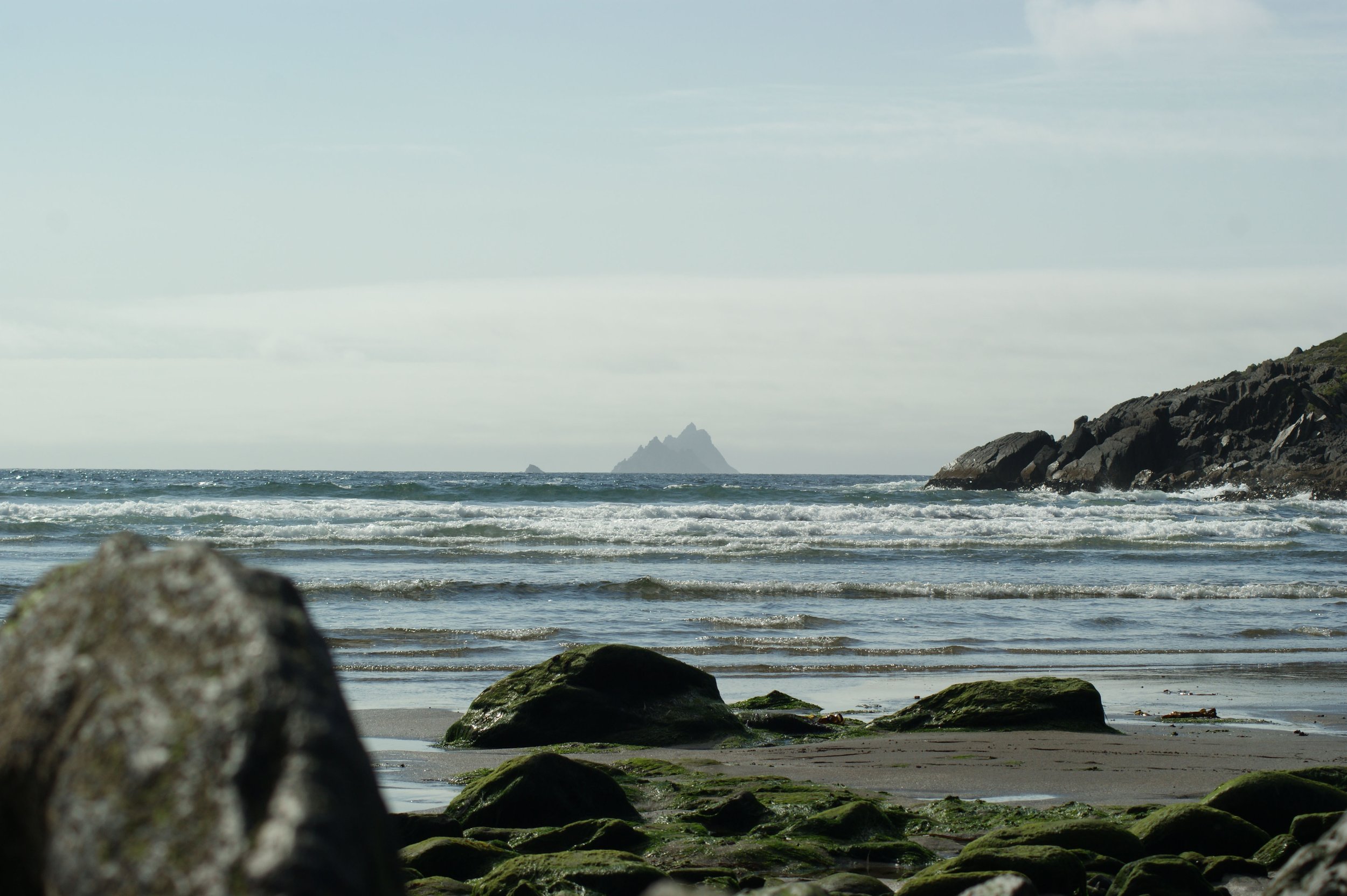
7. Skellig Islands
Along the coast from Bray to Bolus Head, views of the Skellig Islands await you from all angles. The islands are not just famous for their connection to Starwars, but also because of their rich history. Skellig Michael is an UNESCO World Heritage site and known for its monks and their lives in beehive huts, which you can reach after ascending exactly 618 stone steps.
During the summer months they are home to plenty of seabirds, including the Atlantic Puffin (Puifín Atlantach) and Northern Gannet (Gainéad). While puffins rear their pufflings (yes, this is an actual word) inside their burrows on the larger island, parent birds can be seen regularly out in the open, catching fish and carrying them back in their beaks. The largest seabird of the North Atlantic, the Northern Gannet, takes over the smaller of the islands, Little Skellig, making it the second largest gannet colony in the world. Stained by bird guano, its bright white colour makes it easily distinguishable from Skellig Michael. While puffin numbers are low during the winter months, plunge diving gannets can be seen in the waters surrounding the peninsula all year round.
To get onto Skellig Michael, you will need to book a tour often far in advance due to the popularity of the islands. Most boats leave from Portmagee but there are boats from St Finan’s Bay and Derrynane.

8. Bolus & Ducalla Head & WWII Lookout Post No. 34
Bolus Head offers two options to get to the top:
The memorial of the Liberator plane crash, Ducalla (51.814152, -10.337243)
Ballinskelligs Beach car park (51.820841, -10.273165)
The first walk is only approx. 3km long, compared to the approx. 7km of the second walk. Both walks are of medium difficulty, being part on rural tarmac road and part on sheep grazed lands. Signposts with blue arrows (The Skellig Way) will guide you from both directions, while the purple arrows mark the Bolus Loop Walk.
On the very top of the headland and at a height of 270m you will find the second WWII lookout. This one is situated next to a Napoleonic barracks to which is access not permitted to. Walking down towards Ducalla is a large area above the cliffs (51.79694833, -10.35221500). At the height of 50m still you might be lucky enough to spot some of the larger cetaceans passing by, particularly in spring and autumn: Humpback (Míol mór dronnach) and Fin Whales (Droimeiteach).
For those who do not feel like walking, the car park at the Liberator plane crash also offers views into St. Finian’s Bay, towards the Skelligs and the horizon. In that bay, Basking Sharks (Liamhán gréine) have been spotted during the summer and dolphins including Risso’s(Deilf liath), Common (Deilf choiteann) and Bottlenose Dolphin (Deilf bholgshrónach) can be seen close to shore on occasions.
-

9. Ballinskelligs Beach
Easy parking is guaranteed right in front of Café Cois Trá. A short walk down to the beach and you will get a great view of Ballinskelligs Bay, at the 16th century McCarthy’s Castle and the Abbey, a 12th century priory. If you are interested in more on the history of the Skellig monks and islands, there are guided tours of the Skellig Monks Trail available locally. If you follow along the beach south, you will get to Reen Pier, which is one of several departure points to the Skelligs or marine eco tours.
Due to the very low altitude at the beach, sightings of cetaceans are rare, but do happen. One of the species most frequently seen all year round is the Harbour Porpoise (Muc mhara). But closer to shore, on the rocks next to the castle, you may find Seals (Rón) hauled out, or Cormorants (Broigheall) and Shags (Seaga) drying off their feathers.
-

10. Reenroe Beach, Cliffs & Inny Estuary
The cliffs off Reenroe Beach offer a slight elevation with chances to spot some of Iveragh’s most elusive cetaceans: the Harbour Porpoise (Muc mhara). Dolphins and even a Minke Whale (Droimeiteach beag) have also been spotted in Ballinskelligs Bay. The far side of the cliffs is also a good location to watch for wintering birds. Light-bellied Brent Geese (Cadhan), Wigeon (Rualacha), Ringed Plovers (Feadóg chladaigh) and Curlew (Crotach) are only a few of the species that can be seen here over the cold winter months.
Walking back down to the beach, just below the concrete ramp, you will find a few pre-historic tree stumps, dating back 4000 years. Thanks to a storm in 2014 moving sand off beaches, those stumps were exposed, but may eventually be covered by sand deposits again.
The beach carries on for about another km eastwards, before you reach the Inny estuary. Here is another fabulous spot to watch for wetland birds. Amongst all the wildlife to see, you may also look out for things being washed up at the beach. Strandings of dolphins and porpoises are reported to the Irish Whale and Dolphin Group frequently.
-

11. Waterville
Even though it’s down at sea level, Waterville offers spectacular views across Ballinskelligs Bay. While sitting at one of the beachside cafes and enjoying a cuppa, many people have spotted the little Harbour Porpoise (Muc mhara) in the water. Other all year-round inhabitants of the bay include Cormorants (Broigheall), Eurasian Oystercatcher (Roilleach) and Northern Gannets (Gainéad), which you might even see without your binoculars.
If you feel like staying longer in the area and stretching your legs while searching for wildlife, take a look at our guide to the walking route from Waterville to Caherdaniel.
-

12. Hog’s Head
Marked on the map you can see a small area which offers space for 3 to 4 parked cars, from where a 3km walk will lead you to a Napoleonic lookout tower, locally know as ‘the lighthouse’, at a height of 110m.
Many spots along the road offer fantastic views into Ballinskelligs Bay or Derrynane Bay also. At the edge of the latter, Deenish and Scariff Island are part of a Special Protected Area under the EU Birds Directive (2009/147/EC) due to several seabird species breeding on them. Scariff Island itself was also the hideout of priest Fr Francis O’Sullivan when he was wanted by the British and eventually beheaded in 1653. While his remains rest on the island, his preserved head lies at the Killarney Friary. Looking into the bay, Harbour Porpoises (Muc mhara) are frequently seen, but Bottlenose Dolphins (Deilf bholgshrónach) have visited over the years also. Another visitor along the rocky shores is the Risso’s Dolphin (Deilf liath). These shy and often elusive creatures can be easily identified by their grey-white body colour. The older they get, the whiter their bodies turn and are often a nice contrast to the dark ocean.
-

13. Coomakista
Also known as Com an Chiste, this viewing platform offers plenty of space for cars and fantastic views into Kenmare Bay at a height of about 200m. If it is not a Minke Whale (Droimeiteach beag), which can grow up to 8m long, it can be hard to spot smaller cetaceans from here. But if you bring your optics along, you might also get to see dolphins and porpoises.
Looking down on the Waterville side, you may get to see Loher Stone Fort, which is thought to date back to 900 BC. Another way to look at this place is up. Particularly at nighttime. Lying within the Kerry International Dark Sky Reserve (Tearmann Chiarraí na Spéire Dorcha), this location is the perfect spot for star gazers.
-

14. Bull Rock, Cow & Calf Rock
Situated at the entrance to Kenmare Bay and 4km off the most southwesterly tip of the Beara peninsula, BullRock is the largest of the three islands. And possibly the most impressive one. Besides the still operational lighthouse, but unmanned since 1991, this 228m high rock holds another Northern Gannet colony. In good weather conditions you can even catch a ride through the ‘Tunnel to the Underground’.
The next smaller, neighboring island is the Cow Rock, which from a certain ankle, looks like an elephant. Calf Rock is the smallest of the three islands and closest to the Cork coast. The first lighthouse at this stretch of coast was built here from 1861 to 1866, but only lasted 15 years. After it’s destruction through a storm, the current lighthouse on Bull Rock was completed in 1889.
15. Lamb’s Head & WWII Lookout Post No. 33
Arriving at the pier, there is parking space for approximately 5-6 cars. The difficulty in this trail lies in finding the ‘right’ sheep tracks to follow without actual markers. After ascending the stone steps from the pier and continuing through the small gate (please make sure you close that behind you). Tracks can be seen all year round. However, vegetation coverage during the summer can cover the ground you are stepping on, which ranges from rocky to boggy. The coordinates of the watchtower are 51.74050333 (Latitude) and –10.132035 (Longitude). Using the most direct trail takes about 30 minutes to reach the tower. The highest point at this headland is 95m.15
On your way look out for lichen covered rocks where you might find a Kerry Slug (Drúchtín ballach). If you keep your ears open you might also hear the calls of Red-billed Choughs (Cág cosdearg) and Common Ravens (Fiach dubh), which can be seen foraging here frequently.
When arriving at the watch tower, you will have a fantastic view of Derrynane Bay to your right and Kenmare Bay to your left. Straight ahead, you may even be able to spot Bull Rock. The watch tower provides some shelter in stormy weather, but if you are lucky and the weather allows, there are plenty of spots along the headland to sit down, have a sandwich and look out for cetaceans. A number of times through the year, Bottlenose Dolphins (Deilf bholgshrónach) and Minke Whales (Droimeiteach beag) visit the bay, but Common Dolphins (Deilf choiteann) and Harbour Porpoises (Muc mhara) are seen more frequently.
On your way back to the pier, keep your eyes open for the EIRE marker sign. These were built between 1942 and 1943 along the Irish coast to signal passing aircrafts over which land they were passing.
For the most up to date weather insight, you are welcome to check out the Lambs Head Webcam, provided by SCC Broadband.
-

16. Glanbeg Beach
This stop doesn’t include any walking. On the side of the road between Caherdaniel and Sneem, it is easy to stop and take in the scenery. Even though it only overlooks a small part of Kenmare Bay and is close to sea level, Common Dolphins (Deilf choiteann) and Bottlenose Dolphins (Deilf bholgshrónach) are seen in this area. Regardless of the time of year, you might see Cormorants (Broigheall), Shags (Seaga) and the Eurasian Oystercatcher (Roilleach). The first two species can be hard to distinguish from each other. But no other bird has such a unique call as the oystercatcher, in addition to the striking black and white plumage with long, bright orange beak.
If you didn’t get to stop for lunch in Waterville or Caherdaniel, you will have another chance now. O’Carroll’s Cove is a family-owned seafood restaurant, right by the sea. Please check their website for up-to-date opening hours and information.
-

17. Gleesk Pier & Coral Beach
Following a 5km drive down a narrow, windy road, you will arrive at Cé Ghlinsce. It then only takes a short walk to get from the actual pier to the water’s edge, passing two house ruins, before you face south into Kenmare Bay. Despite the low elevation, you can look to the other side of the bay without binoculars and can often see Common Dolphins (Deilf choiteann) swimming by, feeding, socializing and breaching. The bay is home to gannets all year round, similar to Dingle Bay, but during the winter season this spot also offers a great opportunity to see Great Northern Divers (Lóma mór) close to the shore. Common Guillemots (Muiréan) and Razorbills (Crosán) can be seen sitting on the water on occasions also.
One of the rare gems to see near the pier, is one of Irelands two coral beaches. More correctly, it should be addressed as a maërl beach, as it is made of dead, calcified seaweed rather than actual corals.
All the land is privately owned here. We ask visitors to all the stops on our map to not leave any trace, this also applies to the area on and around Gleesk Pier.
-
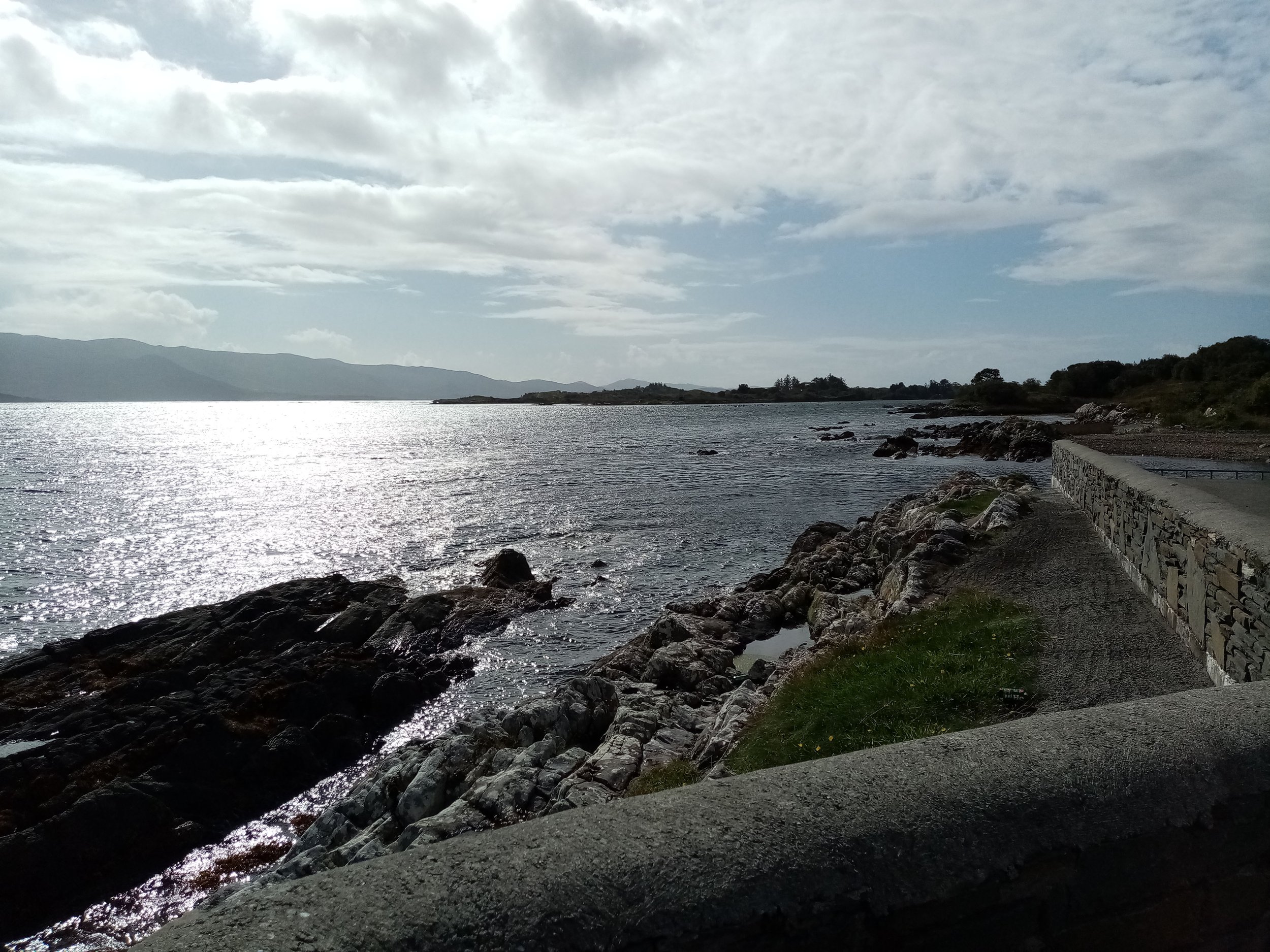
18. Tahilla Pier
This pier is less than 1 minute drive off the N70 Ring of Kerry Road and no hiking is required. Standing at the pier, Tahilla River enters Coongal Harbour from behind. Another low elevation location, you still might get lucky and see Dolphins (Deilf)or Minke Whale (Droimeiteach beag).
Cormorants (Broigheall) and Shags (Seaga) are easy to spot resting on buoys of crab fishing gear and along exposed rocks. A good time to come here is during low tide, because that is when you will have your best chances to see Seals (Rón) hauled out to your left. Other birds that you might observe along the shore are Grey Heron (Corr éisc) and Eurasian Oystercatcher (Roilleach).
Whalewatching on the Iveragh peninsula
With Iveragh’s many headlands, cliffs, and coastal routes, there is no need to get into a boat to look for whales and dolphins (unless you want to!) Watch this video for some tips about looking for marine mammals and contributing to citizen science
If you enjoy hiking and would like to see more of the areas surrounding the watch locations, explore some of the trails here or on the South Kerry Trails of the South Kerry Development Partnership CLG.
There are boat tours available from most of the piers and harbours. Some of these visit the Skelligs or will take you across to West Cork or on an eco or wildlife tour.