
The Geological History of the Iveragh Peninsula
The Iveragh Peninsula has one of the most stunning landscapes in Ireland and is home to a rich range of geological and glacial features that have been over 385 million years in the making. Over that time, the area has travelled across the equator on the slow conveyor belt of plate tectonics, and at various times has been covered by barren deserts, submerged beneath tropical seas, caught up in continental collisions, and overridden by vast ice sheets. Together these events have created the unique and spectacular landscape of Iveragh today. This guide will take you on a journey through time, highlighting the various periods, environments, and earth processes that have helped shape the Iveragh we know today.
Our journey through the geological history of Iveragh starts with the oldest rocks on the peninsula, dating back over 385 million years, and finishes with the modern and ongoing processes of coastal erosion and deposition. Each period tells a compelling piece of the long and fascinating geological history of Iveragh. We have referenced the best places to see the impact of each period on the landscape so you can explore this beautiful region for yourself. For a very brief overview of the geological history of Iveragh, watch our short animation, How Iveragh Came to Be.
The geological map shows the distribution of different rock types across the area. With each different rock type discovered, a new and exciting piece of the story of Iveragh’s geological history is revealed. The Iveragh Peninsula is largely covered by Old Red Sandstone, which is in turn divided into the Valentia Slate Formation, the St Finian’s Sandstone Formation, and the Ballinskelligs Sandstone Formation. Other minor formations are found in the area around Sneem and these include the Gun Point Formation, the Toe Head Formation, and the Old Head Sandstone Formation. The area around Beginish Island and Valentia Harbour also contains a group of volcanic rocks. All these rocks formed during the Devonian Period.

Geological map of the Iveragh Peninsula. Each colour represents a different rock type of rock. The rocks can not be seen at the surface in all areas as they are often covered by soil and vegetation.
Devonian Deserts
The Old Red Sandstones of the Iveragh Peninsula were deposited during the Devonian Period, between approximately 393 to 360 million years ago. During the Devonian, the continents were arranged differently to today. There were two major continental masses: Laurussia and Gondwana. Ireland existed as part of Laurussia and was situated around 15 to 20 degrees south of the Equator. The Old Red Sandstones are found across much of Europe, parts of North America and Greenland and formed when these landmasses were part of the same continent (Kendall, 2017). The presence of these rocks across regions that are now separated by oceans highlights how over the seemingly static face of the globe, the continents are in constant motion, traversing immense distances over huge spans of geological time.
Due to its position close to the equator, Ireland had a hot and relatively dry climate(Russel, 1984). The landscape was dominated by barren deserts, similar to the Arabian Desert today. This desert landscape was subject to frequent flash flooding fed by episodic rainfall events that formed many rivers and small lakes.

Ireland’s position location during the Devonian (Source Geological Survey of Ireland)
At the time, much of Kerry and Cork, including what is now the Iveragh Peninsula, was part of a huge low-lying depression in the landscape, known as the Munster Basin (Naylor & Jones, 1967). This basin is estimated to have extended eastwards as far as the Comeragh Mountains in Waterford. The Munster basin formed through the extension and stretching of the Earth’s crust as tectonic plates pulled apart.
The low-lying land of the Munster Basin acted as the natural drainage site for the floods and rivers that flowed across Iveragh (MacCarthy, 1990; Graham et al., 1992). These carried sediments down from the Caledonian Mountains in the north and deposited them within the basin. Over time, as layers of sand, silt, clay, and pebbles built up, they were compressed under their weight and solidified, forming the layers of Old Red Sandstone that we see today. Many traces of this past floodplain environment can be deciphered from the structures preserved in the rock layers, including ripple marks and mud cracks. Geologists have used this hard evidence to reveal the landscape, environment, and climate of the past.

Succession of rock Formations found on the Iveragh Peninsula.
The area of maximum sediment depth within the Munster Basin is believed to have been situated around what is now Kenmare where over 7km of sediment accumulated (Cooper et al. 1986; MacCathy 1990). The sediment accumulated at an average rate of about one-tenth of a millimetre per year; it would have taken an immense time to form these rocks. The oldest of the rocks in Iveragh belong to the Valentia Slate Formation and would have formed at the bottom of the original sediment pile, these were succeeded by the St. Finian’s Sandstone Formation and finally the Ballinskelligs Sandstone Formation.
Life during the Devonian
The desert and floodplain landscape of the Devonian is far removed from the Iveragh of today and similarly, the diversity of life was very different and much more primitive. However, the Devonian was a period of immense change and progress that saw the expansion of plants and forests across the land, an explosion in marine life and critically the movement of the first animals onto land.
Fossilised plant remains in rocks on Iveragh.
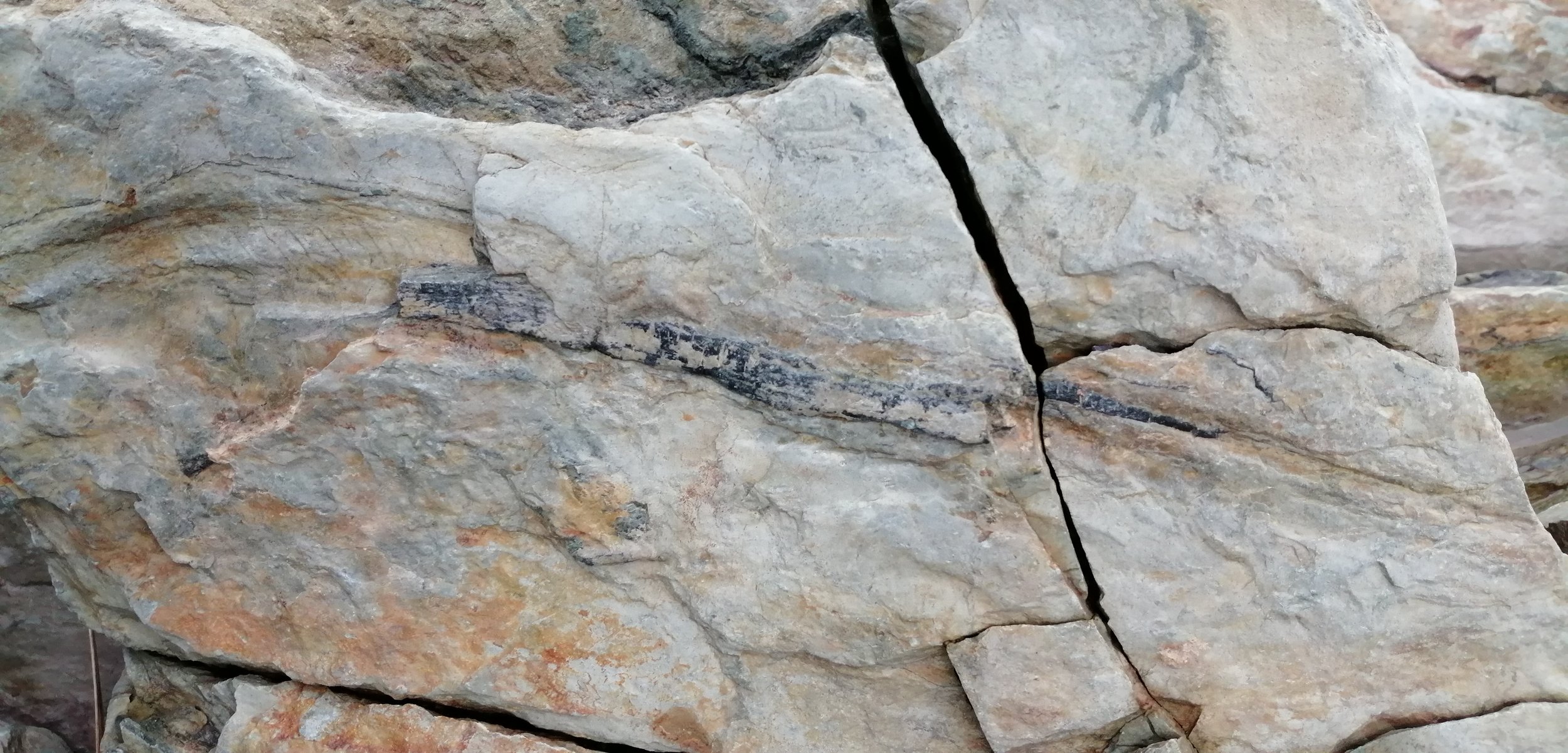
At the beginning of the Devonian, the first ecosystems on land were established but life was restricted to invertebrates, such as arthropods similar to centipedes, mites, and scorpions, as well as simple plants. Later in the Devonian larger and more complex plants began developing and by the Late Devonian, the first forests were established. The first species to resemble a modern tree was Archaeopteris (Meyer-Berthaud et al., 1999). Primitive fossils of Archaeopteris are found on the rocky coast near Valentia Lighthouse. These early trees would have had spiky leaves, but later developed leaves that looked a lot more like ferns.
Due to a huge expansion in aquatic life that occurred during the Devonian this period is often referred to as the Age of the Fishes. In the Silurian, the oceans hosted a rich and diverse range of marine life including brachiopods, crinoids, corals, molluscs, and trilobites, but it was not until the Devonian that the evolution and diversification of fish species really took off. Fossils of ancient fish found at St. Finian’s Bay (Russel, 1978) offer a glimpse into this strange aquatic world.

Tetrapod Trackways at Dohilla, Valentia Island.
Towards the end of Devonian, an amazing transition began as vertebrate animals emerged from their water habitats and began to colonise the land. The first vertebrate to make this move from the water to the land were the tetrapods. These early tetrapods had crocodile-like heads and teeth, raised eyes and adaptations to help them support their own weight and move about on land (Ahlberg, 2018). They would have somewhat resembled modern salamander. Some of the world’s oldest tetrapod evidence is found at Valentia Island, where fossilised footprints have been preserved in the rocks for over 385 million years (Stössel, 1995; Stössel et al., 2016).

Explore more!
To immerse yourself in the world of the Devonian, explore our Valentia Lighthouse Geotrail and visit the Valentia Island Tetrapod trackways.
Volcanic Rocks – An active Earth
Sedimentary rocks were not the only rocks actively forming in the area during the Devonian. As the Munster Basin evolved with the stretching of the continental crust, faults and fractures provided routes for magma from deep within the Earth to rise towards the surface. Some of this magma remained below the surface where it cooled and solidified but other portions broke to the surface as violent volcanic eruptions.
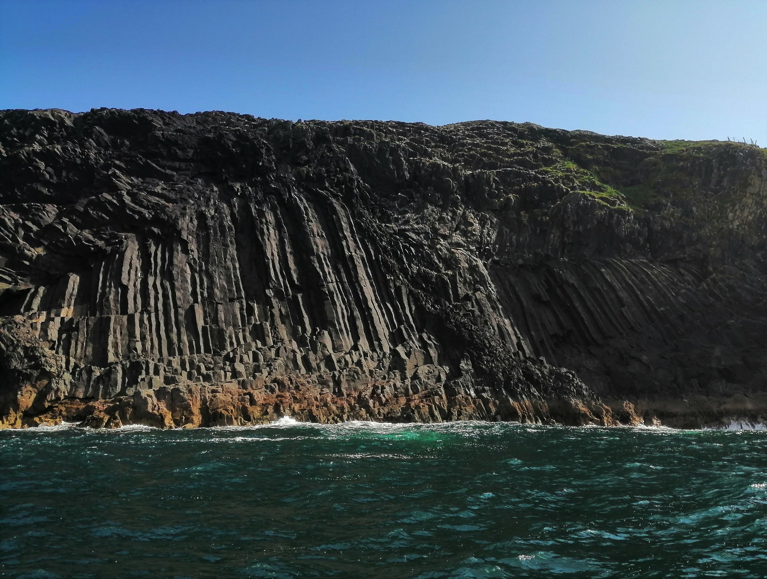
Beginish Island was at the centre of much of the volcanic activity on the Iveragh Peninsula. At Beginish, a large intrusion of an igneous rock called dolerite is exposed at the surface. Dolerite is the coarse-grained equivalent of basalt and has the same mineral composition but bigger crystal grains. The rate of cooling controls the size of mineral crystals, the slower the cooling the larger the crystals. This dolerite formed as a sill. Sills form when hot molten magma is injected into existing horizontal rock layers, where it cools and solidifies. If you get the opportunity, a boat trip out to Beginish Island will bring you up close and personal with some incredible dolerite joint columns. The columns are formed when magma cools. They are like those found at the Giant’s Causeway, although amazingly, the columns at Beginish are over 300 million years older. Dolerite dykes, which are igneous intrusions that cut through existing rock layers, are also found on Valentia Island and at St. Finian’s Bay.
The igneous intrusion at Beginish travelled through the rock layers, over to Whitestrand and Bealtra Bay, over the water from Cahersiveen. As this intrusion moved closer to the surface, it came into contact with wet and uncemented sands and muds that covered the floodplain environment, resulting in an explosive disruption at the surface. As the dolerite broke to the surface it mixed with the wet sediments, as well as volcanic ash and fragments of volcanic rock to form a rock known as volcanic breccia (Graham et al., 1995). This is unique to all other rocks on the peninsula and is among the most interesting geological features.
Another type of igneous rock, known as tuff, is found at certain locations across the peninsula. Tuff is a rock that has an ash content of over 75% of the rock volume and is formed when ejected volcanic ash falls to the ground and hardens into solid rock. Tuff beds are found at Enagh Point on the south side of Doulus Head, on the northeast coast of Valentia Island, as well as at Keel just south of St. Finian’s Bay. The ash in these is believed to have come from nearby Plinian-style volcanic eruptions. Plinian eruptions are the largest and most violent types of volcanic eruptions. These types of eruptions can spew massive mushroom columns of gas and ash up to 50 kilometres into the air and these ash plumes can be blown hundreds of miles from the source. The tuff deposits are important as they contain minerals that have allowed the rocks of the area to be dated. It is from these rocks that geologists have been able to assign an age of around 385 million years to the rocks as well as to the tetrapod trackway (Williams et al., 1997; 2000). Although the exact eruption site is not known, the presence of these ash layers is a clear indicator of more violent times in Iveragh’s history when huge ash clouds engulfed the sky.
To best experience Iveragh’s volcanic past, take a stroll across Whitestrand and Bealtra, Over the Water, using our self-guided geotrail.
Mountain Building
Throughout the Devonian, the continents were gradually drifting towards each other. A continental collision event occurred around 300 million years ago, when Laurussia and Gondwana collided to form the supercontinent Pangaea. During this continental collision, the Iveragh Peninsula got caught up in a mountain building event that had a profound impact on the landscape. Intense pressure squeezed and crumbled the once horizontal Devonian sediments and folded and piled them up to form a vast mountain chain. It was during this event that the mountains of the Macguillycuddy’s Reeks and Dunkerron Mountain ranges were formed and the overall ridge and valley landscape of Iveragh appeared.

Plate reconstruction highlighting Ireland’s position in Pangaea during the Permian Period (Source GSI)
This mountain building is known as the Variscan Orogeny and was at its maximum around 320 to 290 million years ago in Ireland. This event was similar to that currently occurring in the Himalayas where the Eurasian and Indo-Australian plates are being pushed together by the enormous pressure of tectonic plate collisions.

Satellite image highlighting the major synclines and anticlines of the Iveragh Peninsula.
During the mountain building, compression acting on the rock bent and deformed the rock layers to form a series of folds known as synclines and anticlines. Anticlines are n-shaped folds that usually form mountain peaks, while synclines are u-shaped folds that usually form valleys. The major synclines and anticlines that define the structure of the landscape are the Portmagee anticline, which runs to the south of Cahersiveen and past Portmagee, the Inny syncline that runs from the south of Bolus Head, through Ballinskelligs Bay and further eastwards almost as far as Glencar, and the final major anticline is the Waterville Anticline that runs inland from Waterville village (Capewell, 1975). Looking at a map of the area it is clear that these major synclines and anticlines are the shaping force of the major valleys and mountain ridges found across Iveragh.
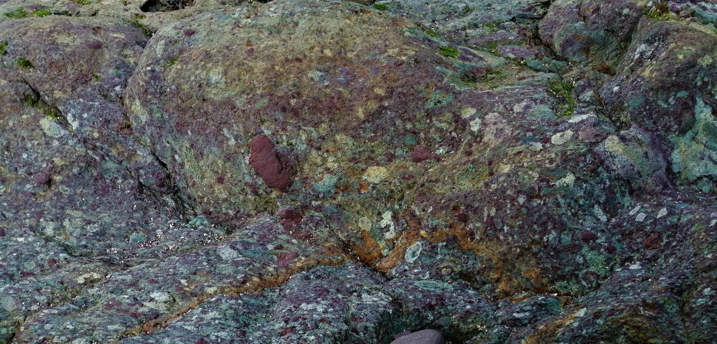
The impact of this mountain building event can be seen across the rocks of the Iveragh Peninsula. Where rock sections are exposed along coastal regions, they often appear distinctly folded and undulated. The rocks of the area underwent low-grade metamorphism whereby the mudstones were transformed into slate (Blackmore, 1995; Meere, 1995). During the metamorphism, the clay grains within the mudrocks were reorganised and realigned into parallel layers, which allow the rock to break along distinctly smooth and flat surfaces, which is why the Valentia Slates are so useful in flooring and roofing.
As the rocks of Iveragh were squeezed and folded, the entire area was also shortened by about 50% of its former extent during the Devonian (Cooper, et al., 1986). This means that many of the features preserved in the rock, such as the tetrapod trackways, were originally larger than what we see today.

Dunkerron Mountain Range.
To take in the sheer immensity of the geological force needed to create this landscape there is no better place to visit than Sneem with the Dunkerron mountains looming to the North of the village. The Fermoyle looped trail crosses this remarkable landscape and the mountains themselves offer excellent hiking through intriguing geologic and glacial scenery.
A walk up Beentee Hill in Cahersiveen also provides some spectacular panoramic views that highlight how the land was sculpted by the Variscan Orogeny.
Palaeogene Volcanics
Following the Variscan Orogeny, the environment and climate continued to change as governed by the slow drift of the continents. The landscape went through several cycles of being alternately covered by sea and arid deserts. Within the tropical seas of the Carboniferous, which teemed with corals, crinoids, and other invertebrates, vast areas of fossil-rich limestone were deposited across Ireland. These Carboniferous limestones account for almost half of the rocks exposed across the surface of Ireland today and are exposed in the areas around Glenbeigh, Killorglin, and Killarney. However, none of this geological history is preserved in the rocks of Iveragh, due to the removal of the younger cover of strata by erosion to reveal the Old Red Sandstones. The story picks up again around 66 million years ago in a period known as the Palaeogene.
The major event occurring at the time was the opening of the North Atlantic Ocean, as tectonic activity caused North America to pull apart from Europe. As the continental crust was torn apart, huge volumes of molten rock from deep within the Earth upwelled to the surface. These active earth movements had a considerable impact on the Irish landscape and the famous Giant’s Causeway in County Antrim was formed during this period. Iveragh also felt some impact of this huge event. At Hog’s Head and Lamb’s Head small igneous intrusions called dykes are found. These dykes formed as the upwelling magma spread out and forced its way through vertical cracks in the Earth’s crust and cooled, without ever erupting to the surface as the violent eruption you might expect.
The Pleistocene Glaciations
By the Quaternary, our present geological period which began 2.6 million years ago, Ireland had completed its northward drift and obtained its present geographic position. Around this time, the global climate began to oscillate between periods of warm and extreme cold. During the cold periods, great ice sheets built up across Ireland and much of the northern hemisphere, profoundly changing the landscape. While Ireland was covered by ice on several occasions the glacial deposits and features of Iveragh mostly come from the Last Glacial Maximum (Coxon & McCarron, 2009), a period of ice advance that was at its greatest extent around 25,000 years ago (Roberts, et al., 2020).
At that time much of southwest Ireland was occupied by an ice body that radiated outwards from an ice dispersal centre near Kenmare (Wright, 1927; Farrington, 1954; Warren, 1979, 1991). This ice body is referred to as the Kerry-Cork Ice Cap and may have reached monumental thicknesses of up to 1km in places. While some of the tallest peaks in the region may have stood above the ice as nunataks, most of the region would have been blanketed by this expansive ice sheet (Rae et al., 2004; Barth et al., 2016). This enormous ice body advanced across the peninsula in a dominantly south-westerly direction towards the Atlantic. Evidence for this movement can be seen on Iveragh’s southern coast (Ballantyne et al., 2011), where large swathes of south-westerly orientated glacially smoothed bedrock are found. As this ice body advanced it was fed by local glaciers that flowed down from the mountains. In northern Iveragh there was also a northern component to ice flow into the area that is now Dingle Bay.
Much of Iveragh’s landscape from hills, valleys, and river courses are structurally controlled by the underlying bedrock, particularly the structure established during the Variscan Orogeny, and would have been quite well established before glaciation. However, these ice sheets did impact the surface features of Iveragh and left behind a distinctly ice sculpted terrain.
As the ice sheets moved across the area, they shaped and moulded the landscape, further carving out beautiful valleys such as the Inny Valley. Across the lowlands, smoothed bumps and mounds of bedrock called Roches moutonnée were created, these are particularly abundant in Sneem and the Glen. In the mountains, wide and deep amphitheatre shaped hollows, known as corries, were carved into the sides of the mountains. Corries are extremely abundant and particularly stunning in the Dunkerron Mountains.
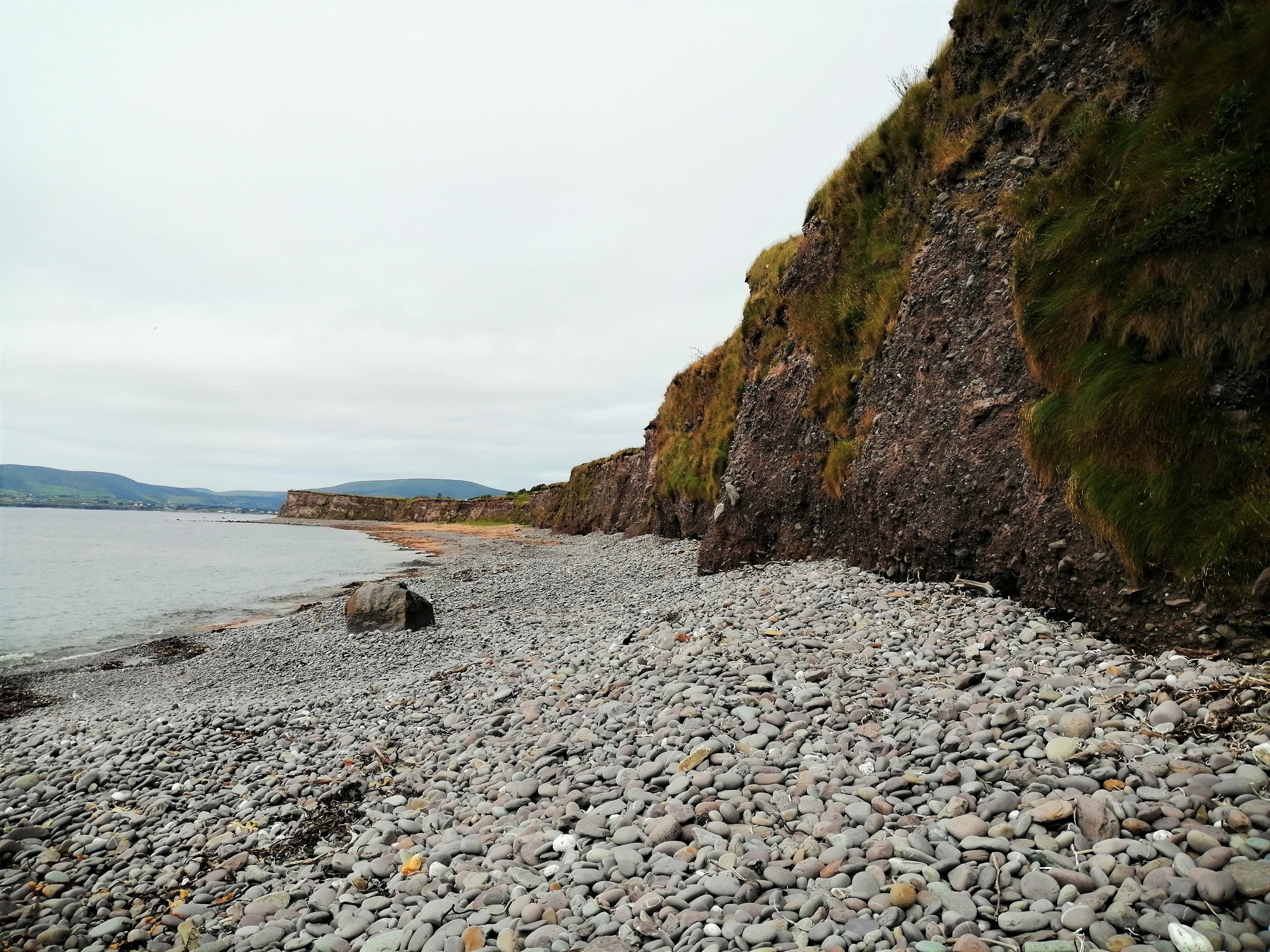
Cliffs of glacial deposits at Waterville.
As the glaciers moved across the land they acted not only as an erosive force but also collected large amounts of debris that fell onto the surface of the glacier, were picked up from the underlying earth or bulldozed by the glacier as it advanced. As the ice retreated and melted at the end of the Ice Age, these sediments were dumped and left behind. Deposits of this glacial material can be seen exposed along much of the coastline, particularly impressively at Waterville. In some areas, these deposits take the form of moraines. Moraines are distinctly smoothed mounds of glacial deposits. Their formation is related to the fact the glacial retreat was not a simple event but involved many periods of stagnation and readvance, meaning that sediments were deposited gradually in different locations. Some of these mounds have a distinctly hummocky and undulating appearance and are known as hummocky moraines. Moraine deposits blanket the land around Sneem and the Cummeragh Valley and can be clearly seen near Staigue Stone Fort. Hundreds of boulders, known as glacial erratics were scattered across the landscape by these ice sheets. A glacial erratic at Ballinskellig Pier is composed of granite and was likely transported all the way from Galway!
Towards the end of the last glacial period, as ice sheets were beginning to retreat, huge volumes of meltwater rich in rocks and debris were produced. This rapidly moving and highly erosive mixture of water and sediment drained through low-lying regions and carved impressive meltwater channels. Such meltwater channels are common along the north coast of Iveragh, where water drained between the mountain peaks from Castlequin to Glenbeigh. To see these features for yourself visit Cuas Crom (Cooncrome) and Kells Bay.

Lough Currane located in Waterville and dammed by glacial deposits.
As this meltwater drained across the landscape, Iveragh also became scattered with numerous lakes. Many of the upland corries across Iveragh contain lakes known as tarns, which formed as meltwater collected in the eroded hollows. The moraine deposits that are widespread in the Cummeragh Valley also trapped and dammed draining meltwater to form a series of lakes of which Lough Currane, which drains into Ballinskelligs Bay, is the largest (Evans et al., 2013). Dromtine Lough, as well as the smaller Lomanagh and Black Loughs in Sneem, are glacial kettle lakes. Kettle lakes form as ice chunks break away from receding glaciers and the rafted blocks of ice become buried in sediment. Gradually, the residual ice block melts, forming a depression in the sediments which is infilled with meltwater.
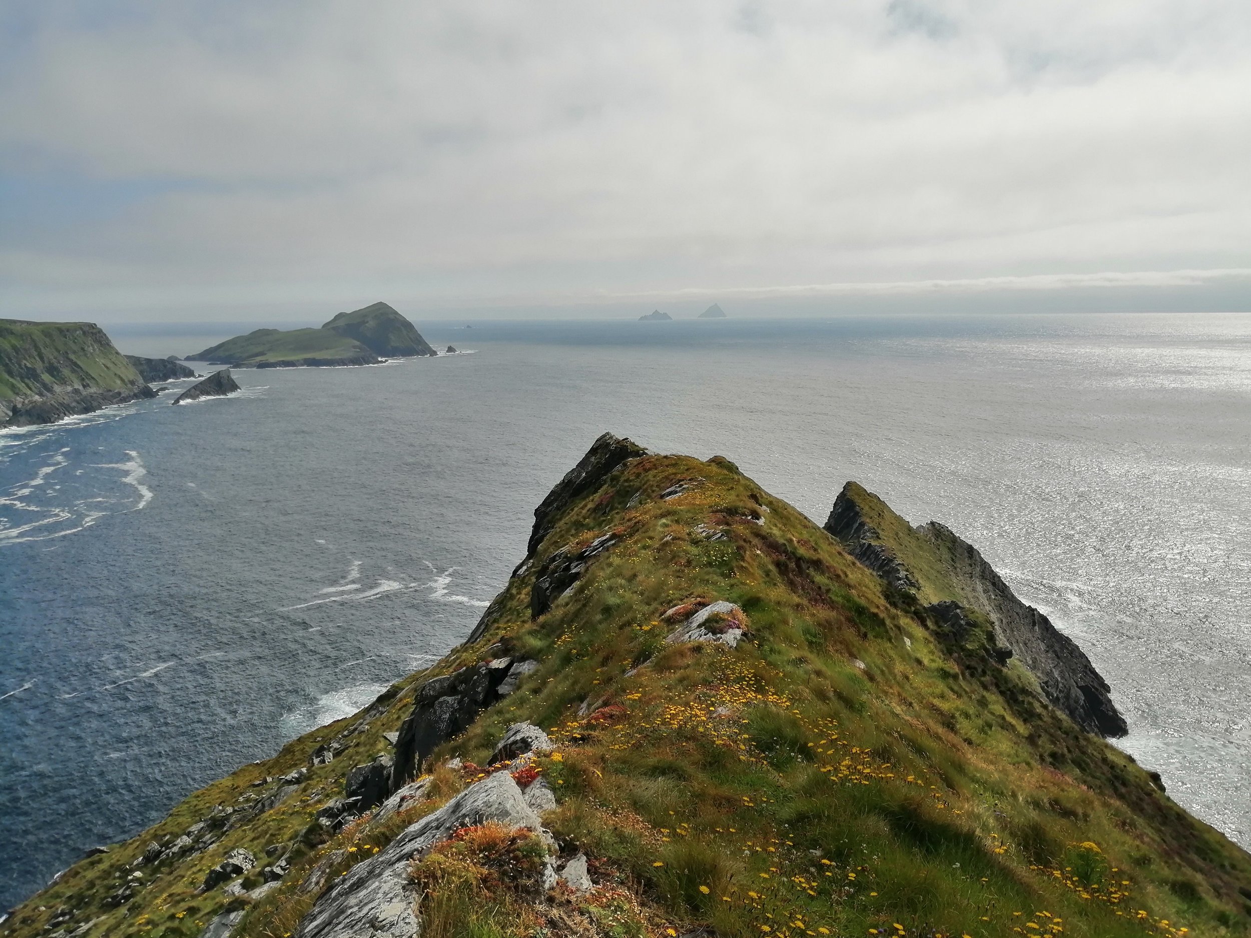
Puffin Island and the Skelligs from the Kerry Cliffs.
Throughout the Quaternary, the Irish coastline has experienced considerable variations in sea level due to the oscillating growth and decay of ice sheets. During the last glacial period, so much water was locked up in ice sheets that global sea level was roughly 120m lower (Clark & Mix, 2002). As the ice sheets began to melt, sea-level rose rapidly and the coastline as we know it today began to take shape. It is during the post-glacial sea-level rise that many of Iveragh’s iconic islands such as the Skelligs, Puffin Island, and Deenish and Scariff became isolated from the mainland. During this period the drowned valleys at Kenmare Bay and Dingle Bay were also flooded, and the present coastline of Iveragh began to take shape.
After the Ice - The Holocene
The last chapter of Iveragh’s geological history is recorded by the pollen preserved within the soils and bogs of the island. The period after the glaciation is known as the Holocene and began 11,700 years ago and continues to the present day. During the glacial period, most plants could not withstand the harsh environment and were restricted to warmer ice-free refugia in southern Europe. As the glaciation ended, around 14,000 years ago (Ballantyne et al., 2009), the climate gradually warmed and plants began to rapidly recolonise Ireland. Initially, the landscape would have been dominated by some sparse herb, sedge, and grass coverage(Andrieu-Ponel et al., 1993). The first plants in post-glacial Ireland were largely low-lying shrubs and species such as juniper, dwarf birch and dwarf willow. By the time first humans arrived in Iveragh, probably over 9,000 years ago, the area would have been dominated by dense woodland of oak, pine, hazel, birch, willow, yew. This Ireland was home to the famous Giant Irish deer along with reindeer, wolves, and brown bears.

IPCC Reserve Coad Bog.
The arrival of humans profoundly impacted the landscape. The clearance of land by human settlers through deforestation, burning and grazing provided the ideal conditions for the growth and expansion of peat. Over thousands of years, this peat has built up to form blanket bogs, creating a rare and biodiverse habitat in the process. Much of Iveragh’s landscape is now dominated by blanket bog and squelchy fields and hillsides are a common theme across the area.
Coad Bog, located between Caherdaniel and Castle Cove is an Irish Peatland Conservation Council (IPCC) reserve. Located between Sneem and Caherdaniel, Coad Bog is an ideal spot for those eager to explore Ireland’s unique blanket bogs.
Copper Mining
During the Devonian, as the continental crust stretched to form the Munster Basin, faults and fractures formed and grew. These fractures provided pathways for hot fluids to circulate through the rock layers. As these fluids cooled, minerals crystallised, and veins formed. These veins are mostly composed of quartz but in some places they also contained copper minerals. Some of the copper in the area is found within the sedimentary rocks themselves and is therefore known as sediment-hosted copper. Sediment-hosted copper forms when copper-bearing fluid mixes through permeable sedimentary rocks and copper minerals crystalise on the sediment surface.
These copper deposits would have been of great value to the people that inhabited the area during the Bronze Age. At Lamb’s Head and near Staigue Fort the presence of ancient copper mines highlight the deep geological knowledge and connection that the earlier settlers must have had with the land.
Read more about copper mining in our article here.
Copper mining occurred sporadically until as recently as 1861 (Greenville, 1992).
Coastal Geology
The formation of Iveragh’s landscape is ongoing and geology can be seen in action in the present day. On land, this reshaping largely takes place through the wearing down of mountains by rivers and streams. While this occurs at quite a slow pace the power of the ocean can create much faster change.

Kerry Cliffs in Portmagee
Since the end of the glaciation, our coastline has experienced the full ferocity of the Atlantic Ocean and has endured thousands of years of storm-battering and wave-smashing. The Atlantic has worked against the rocks of Iveragh’s coast, exploiting variations in rock hardness, orientation and seeking out zones of weaknesses created by fractures and faults. This has resulted in the creation of an array of impressive landforms, from the towering Kerry Cliffs, the alluring caves that line Iveragh’s headlands, and the sea stacks and stumps that litter the base of Bray Head.
However, it’s not only coastal erosion that has shaped Iveragh’s coastline. Coastal deposition is responsible for creating the golden shores of Derrynane and Reenroe backed by their impressive sand dunes, the imposing storm beach at Waterville and the stretching sandspit at Glenbeigh.
While these coastal features may seem unmoving and permanent, they are temporary forms that will eventually disappear as the relentless cycle of erosion and deposition continues. Ultimately these processes will be followed by rebuilding and new rock formation, as the geological cycle continues far into the future.